Case 0: Linares

แก้
Side by side comparison
{{กล่องข้อมูล นิคม}}{{กล่องข้อมูล นิคม/sandbox}}
Linares
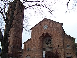
Cathedral of Linares
Flag
ธง
Coat of arms
ตราอาร์ม
Location in the Maule Region
Location in Chile
Location in Chile
Linares
Location in Chile
พิกัด: 35°51′S 71°36′W / 35.850°S 71.600°W / -35.850; -71.600
CountryChile
RegionMaule
ProvinceLinares
FoundedMay 23, 1794
Founded asVilla de San Ambrosio de Linares
การปกครอง[1]
 • ประเภทMunicipality
 • AlcaldeRolando Rentería Möller
พื้นที่[2]
 • ทั้งหมด1,456.7 ตร.กม. (562.4 ตร.ไมล์)
ประชากร
 (2002 Census)[2]
 • ทั้งหมด83,249 คน
 • ความหนาแน่น57 คน/ตร.กม. (150 คน/ตร.ไมล์)
 • Urban68,224
 • Rural15,025
เดมะนิมLinarense
Sex[2]
 • Men40,518
 • Women42,731
เขตเวลาUTC−4 (CLT [3])
 • ฤดูร้อน (เวลาออมแสง)UTC−3 (CLST [4])
รหัสพื้นที่56 + 73
รหัส ISO 3166CL-LIN
เว็บไซต์Municipality of Linares
Linares
Cathedral of Linares
Flag
Coat of arms
Location in the Maule Region
Location in Chile
Location in Chile
Linares
Location in Chile
พิกัด: 35°51′S 71°36′W / 35.850°S 71.600°W / -35.850; -71.600
CountryChile
RegionMaule
ProvinceLinares
FoundedMay 23, 1794
Founded asVilla de San Ambrosio de Linares
การปกครอง
 • ประเภทMunicipality
 • AlcaldeRolando Rentería Möller
พื้นที่
 • ทั้งหมด1,456.7 ตร.กม. (562.4 ตร.ไมล์)
ประชากร
 (2002 Census)[2]
 • ทั้งหมด83,249 คน
 • ความหนาแน่น57 คน/ตร.กม. (150 คน/ตร.ไมล์)
 • Urban
68,224
 • Rural
15,025
เดมะนิมLinarense
Sex
 • Men40,518
 • Women42,731
เขตเวลาUTC−4 (CLT [3])
 • ฤดูร้อน (เวลาออมแสง)UTC−3 (CLST [4])
รหัสโทรศัพท์56 + 73
รหัส ISO 3166CL-LIN
เว็บไซต์Municipality of Linares

Case 1: Detroit

แก้
Side by side comparison
{{กล่องข้อมูล นิคม}}{{กล่องข้อมูล นิคม/sandbox}}
Detroit

Ciudad de Autos

OtherName
City
City of Detroit
Tall buildings with city lights at dusk, reflected over still dark water
Skyline of Detroit
Quartered flag. Top left: blue with 17 white stars. Top right: Red with 3 golden lions. Bottom left: White with 5 gold fleur-de-lis. Bottom right: 13 alternating white and red stripes, diagonally downward. Center is covered by the city seal in color
ธง
Light blue seal with two women, "THE CITY OF DETROIT", "MICHIGAN", and the city motto in Latin
ตรา
สมญา: 
Motor City, Motown, Rock City, The D
คำขวัญ: 
"Speramus Meliora; Resurget Cineribus"
(Latin for, "We Hope For Better Things; It Shall Rise From the Ashes")
Detroit covers most of the northeast part of Wayne County, which in turn is in the far southeast of Michigan.
พิกัด: 42°19′53″N 83°2′45″W / 42.33139°N 83.04583°W / 42.33139; -83.04583[5]
CountryUnited States
StateMichigan
CountyWayne County
Founded1701
Incorporation1806
การปกครอง[6]
 • ประเภทStrong Mayor–Council
 • MayorKwame Kilpatrick (D)
 • Deputy MayorJohn Doe
 • Deputy Mayor's SidekickJane Doe
 • City ManagerJohn Doe, Jr.
 • City ClerkJohn Doe, III
พื้นที่[7]
 • City143.0 ตร.ไมล์ (370 ตร.กม.)
 • พื้นดิน138.8 ตร.ไมล์ (359 ตร.กม.)
 • พื้นน้ำ4.2 ตร.ไมล์ (11 ตร.กม.)  2.9%
 • เขตเมือง1,295 ตร.ไมล์ (3,350 ตร.กม.)
 • รวมปริมณฑล3,913 ตร.ไมล์ (10,130 ตร.กม.)
ความสูง[5]600 ฟุต (200 เมตร)
ประชากร
 (2006)[8]
 • City871,121 คน
 • อันดับ554th
 • ความหนาแน่น6,100 คน/ตร.ไมล์ (2,400 คน/ตร.กม.)
 • เขตเมือง3,903,377 คน
 • รวมปริมณฑล4,468,966 คน
เขตเวลาUTC−5 (EST)
 • ฤดูร้อน (เวลาออมแสง)UTC−4 (EDT)
รหัส ISO 3166US-DET
เว็บไซต์www.detroitmi.gov
Infobox footnotes placed here
Detroit
Ciudad de Autos
OtherName
City
City of Detroit
Tall buildings with city lights at dusk, reflected over still dark water
Skyline of Detroit
Quartered flag. Top left: blue with 17 white stars. Top right: Red with 3 golden lions. Bottom left: White with 5 gold fleur-de-lis. Bottom right: 13 alternating white and red stripes, diagonally downward. Center is covered by the city seal in color
Light blue seal with two women, "THE CITY OF DETROIT", "MICHIGAN", and the city motto in Latin
Nicknames: 
Motor City, Motown, Rock City, The D
Motto(s): 
"Speramus Meliora; Resurget Cineribus"
(Latin for, "We Hope For Better Things; It Shall Rise From the Ashes")
Detroit covers most of the northeast part of Wayne County, which in turn is in the far southeast of Michigan.
พิกัด: 42°19′53″N 83°2′45″W / 42.33139°N 83.04583°W / 42.33139; -83.04583[5]
CountryUnited States
StateMichigan
CountyWayne County
Founded1701
Incorporation1806
การปกครอง
 • ประเภทStrong Mayor–Council
 • MayorKwame Kilpatrick (D)
 • Deputy MayorJohn Doe
 • Deputy Mayor's SidekickJane Doe
 • City ManagerJohn Doe, Jr.
 • City ClerkJohn Doe, III
พื้นที่
 • City143.0 ตร.ไมล์ (370 ตร.กม.)
 • พื้นดิน138.8 ตร.ไมล์ (359 ตร.กม.)
 • พื้นน้ำ4.2 ตร.ไมล์ (11 ตร.กม.)  2.9%
 • เขตเมือง
1,295 ตร.ไมล์ (3,350 ตร.กม.)
 • รวมปริมณฑล
3,913 ตร.ไมล์ (10,130 ตร.กม.)
ความสูง600 ฟุต (200 เมตร)
ประชากร
 (2006)[8]
 • City871,121 คน
 • อันดับ554th
 • ความหนาแน่น6,100 คน/ตร.ไมล์ (2,400 คน/ตร.กม.)
 • เขตเมือง
3,903,377
 • รวมปริมณฑล
4,468,966
เขตเวลาUTC−5 (EST)
 • ฤดูร้อน (เวลาออมแสง)UTC−4 (EDT)
รหัส ISO 3166US-DET
เว็บไซต์www.detroitmi.gov
Infobox footnotes placed here

Case 2: Ziketan Town

แก้
Side by side comparison
{{กล่องข้อมูล นิคม}}{{กล่องข้อมูล นิคม/sandbox}}
Ziketan Town

子科滩镇
Ziketan Townตั้งอยู่ในประเทศจีน
Ziketan Town
Ziketan Town
Location within China
พิกัด: 35°35′19″N 99°59′12″E / 35.588525°N 99.986558°E / 35.588525; 99.986558
CountryChina
ProvinceQinghai
PrefectureHainan
CountyXinghai
Established1953
การปกครอง
 • MayorChote Chaba
พื้นที่3,000 ตร.กม. (1,158 ตร.ไมล์)
ความสูง3,193 เมตร (10,476 ฟุต)
ประชากร
10,000 คน
 • ความหนาแน่น3.3 คน/ตร.กม. (8.6 คน/ตร.ไมล์)
Ethnicity
 • Tibetan80%
เขตเวลาUTC+8 (China Standard Time)
รหัส ISO 3166CN-123
Qinghai e-Gov Portal
Ziketan Town
子科滩镇
Ziketan Townตั้งอยู่ในประเทศจีน
Ziketan Town
Ziketan Town
Location within China
พิกัด: 35°35′19″N 99°59′12″E / 35.588525°N 99.986558°E / 35.588525; 99.986558
CountryChina
ProvinceQinghai
PrefectureHainan
CountyXinghai
Established1953
การปกครอง
 • MayorChote Chaba
พื้นที่
3,000 ตร.กม. (1,158 ตร.ไมล์)
ความสูง
3,193 เมตร (10,476 ฟุต)
ประชากร
10,000
 • ความหนาแน่น3.3 คน/ตร.กม. (8.6 คน/ตร.ไมล์)
Ethnicity
 • Tibetan80%
เขตเวลาUTC+8 (China Standard Time)
รหัส ISO 3166CN-123
Qinghai e-Gov Portal

Case 3: Ponte San Giovanni

แก้
Side by side comparison
{{กล่องข้อมูล นิคม}}{{กล่องข้อมูล นิคม/sandbox}}
Ponte San Giovanni
CountryItaly
RegionUmbria
ProvincePerugia (PG)
ComunePerugia
พื้นที่
 • ทั้งหมด18 ตร.กม. (7 ตร.ไมล์)
ความสูง190 เมตร (620 ฟุต)
ประชากร
 • ทั้งหมด13,296 คน
 • ความหนาแน่น740 คน/ตร.กม. (1,900 คน/ตร.ไมล์)
เดมะนิมPonteggiani
เขตเวลาUTC+1 (CET)
 • ฤดูร้อน (เวลาออมแสง)UTC+2 (CEST)
Postal code06135
Dialing code075
เว็บไซต์Circoscrizione n° 8, Comune di Perugia
Ponte San Giovanni
CountryItaly
RegionUmbria
ProvincePerugia (PG)
ComunePerugia
พื้นที่
 • ทั้งหมด18 ตร.กม. (7 ตร.ไมล์)
ความสูง
190 เมตร (620 ฟุต)
ประชากร
 • ทั้งหมด13,296 คน
 • ความหนาแน่น740 คน/ตร.กม. (1,900 คน/ตร.ไมล์)
เดมะนิมPonteggiani
เขตเวลาUTC+1 (CET)
 • ฤดูร้อน (เวลาออมแสง)UTC+2 (CEST)
Postal code
06135
Dialing code075
เว็บไซต์Circoscrizione n° 8, Comune di Perugia

Case 4: Gorssel

แก้
Side by side comparison
{{กล่องข้อมูล นิคม}}{{กล่องข้อมูล นิคม/sandbox}}
Gorssel
Dorp
พิกัด: 52°12′N 6°12′E / 52.200°N 6.200°E / 52.200; 6.200
CountryNetherlands
ProvinceGelderland
MunicipalityLochem
พื้นที่
 • ทั้งหมด1.807 ตร.กม. (0.698 ตร.ไมล์)
ประชากร
 (2006)
 • ทั้งหมด1,807 คน
 • ความหนาแน่น1,000 คน/ตร.กม. (2,600 คน/ตร.ไมล์)
Secret password"Luite Klaver"
Favorite colorTurquoise

Case 5: Herāt

แก้
Side by side comparison
{{กล่องข้อมูล นิคม}}{{กล่องข้อมูล นิคม/sandbox}}
Herāt

هرات
City
Overview of Herat City
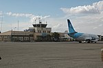
Herat Airport
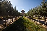
Citadel of Herat
Friday Mosque of Herat Musalla Complex
สมญา: 
Pearl of Khorasan
Herātตั้งอยู่ในประเทศอัฟกานิสถาน
Herāt
Herāt
Location in Afghanistan
พิกัด: 34°20′31″N 62°12′11″E / 34.34194°N 62.20306°E / 34.34194; 62.20306
Country อัฟกานิสถาน
ProvinceHerat Province
ความสูง920 เมตร (3,020 ฟุต)
ประชากร
 (2006)
 • ทั้งหมด397,456 คน
 [10]
เขตเวลาUTC+4:30 (Afghanistan Standard Time)
Herāt
هرات
City
Overview of Herat City
Herat Airport
Citadel of Herat
Friday Mosque of Herat Musalla Complex
Nickname(s): 
Pearl of Khorasan
Herātตั้งอยู่ในประเทศอัฟกานิสถาน
Herāt
Herāt
Location in Afghanistan
พิกัด: 34°20′31″N 62°12′11″E / 34.34194°N 62.20306°E / 34.34194; 62.20306
Country อัฟกานิสถาน
ProvinceHerat Province
ความสูง
920 เมตร (3,020 ฟุต)
ประชากร
 (2006)
 • ทั้งหมด397,456 คน
 [10]
เขตเวลาUTC+4:30 (Afghanistan Standard Time)

Case 6: Baghdad

แก้
Side by side comparison
{{กล่องข้อมูล นิคม}}{{กล่องข้อมูล นิคม/sandbox}}
Baghdad

بغداد
City
بغداد Baġdād
Country อิรัก
ProvinceBaghdad
Established762 AD
ผู้ก่อตั้งAbu Jafar al-Mansour
การปกครอง
 • ประเภทMayor–council
 • องค์กรBaghdad City Advisory Council
 • MayorSaber Nabet Al-Essawi
พื้นที่
 • ทั้งหมด2,260.2 ตร.กม. (872.7 ตร.ไมล์)
ความสูง34 เมตร (112 ฟุต)
ประชากร
 (1987 census)
 • ทั้งหมด3,841,268 คน
 • ประมาณ 
(2011)
7,216,040 คน
 • อันดับ1st
 • ความหนาแน่น1,700 คน/ตร.กม. (4,400 คน/ตร.ไมล์)
 [11][12]
เขตเวลาUTC+3 (Arabia Standard Time)
 • ฤดูร้อน (เวลาออมแสง)No DST
Vehicle registrationxxxx
Baghdad
بغداد
City
بغداد Baġdād
Country อิรัก
ProvinceBaghdad
Established762 AD
ผู้ก่อตั้งAbu Jafar al-Mansour
การปกครอง
 • ประเภทMayor–council
 • BodyBaghdad City Advisory Council
 • MayorSaber Nabet Al-Essawi
พื้นที่
 • ทั้งหมด2,260.2 ตร.กม. (872.7 ตร.ไมล์)
ความสูง
34 เมตร (112 ฟุต)
ประชากร
 (1987 census)
 • ทั้งหมด3,841,268 คน
 • ประมาณ 
(2011)
7,216,040
 • อันดับ1st
 • ความหนาแน่น1,700 คน/ตร.กม. (4,400 คน/ตร.ไมล์)
 [11][12]
เขตเวลาUTC+3 (Arabia Standard Time)
 • ฤดูร้อน (เวลาออมแสง)No DST
Vehicle registrationxxxx

Case 7: Sequim, Washington

แก้

Test multiple pushpin maps and image_alt

Side by side comparison
{{กล่องข้อมูล นิคม}}{{กล่องข้อมูล นิคม/sandbox}}
Sequim, Washington

Fake native name (Fake language)
Another fake native name (second fake language)
Black and white photograph of a lighthouse
สมญา: 
Sunny Sequim
Sequim, Washingtonตั้งอยู่ในรัฐวอชิงตัน
Sequim, Washington
Sequim, Washington
Sequim, Washington
Sequim, Washingtonตั้งอยู่ในสหรัฐ
Sequim, Washington
Sequim, Washington
Sequim, Washington (สหรัฐ)
พิกัด: 48°4′41″N 123°6′5″W / 48.07806°N 123.10139°W / 48.07806; -123.10139
CountryUnited States
StateWashington
CountyClallam
พื้นที่[13]
 • City6.37 ตร.ไมล์ (16.50 ตร.กม.)
 • พื้นดิน6.31 ตร.ไมล์ (16.34 ตร.กม.)
 • พื้นน้ำ0.06 ตร.ไมล์ (0.16 ตร.กม.)
ความสูง184 ฟุต (56 เมตร)
ประชากร
 • City6,606 คน
 • ประมาณ 
(2015)[14]
6,826 คน
 • ความหนาแน่น1,046.9 คน/ตร.ไมล์ (404.2 คน/ตร.กม.)
 • รวมปริมณฑล28,000 +/- คน
เขตเวลาUTC−8 (Pacific (PST))
 • ฤดูร้อน (เวลาออมแสง)UTC−7 (PDT)
ZIP Code98382
Area code360
FIPS code53-63385
GNIS feature ID1531505[16]
เว็บไซต์City of Sequim
Sequim, Washington
Fake native name (Fake language)
Another fake native name (second fake language)
Black and white photograph of a lighthouse
Nickname(s): 
Sunny Sequim
Sequim, Washingtonตั้งอยู่ในรัฐวอชิงตัน
Sequim, Washington
Sequim, Washington
Sequim, Washington
Sequim, Washingtonตั้งอยู่ในสหรัฐ
Sequim, Washington
Sequim, Washington
Sequim, Washington (สหรัฐ)
พิกัด: 48°4′41″N 123°6′5″W / 48.07806°N 123.10139°W / 48.07806; -123.10139
CountryUnited States
StateWashington
CountyClallam
พื้นที่
 • City6.37 ตร.ไมล์ (16.50 ตร.กม.)
 • พื้นดิน6.31 ตร.ไมล์ (16.34 ตร.กม.)
 • พื้นน้ำ0.06 ตร.ไมล์ (0.16 ตร.กม.)
ความสูง
184 ฟุต (56 เมตร)
ประชากร
 • City6,606 คน
 • ประมาณ 
(2015)[14]
6,826
 • ความหนาแน่น1,046.9 คน/ตร.ไมล์ (404.2 คน/ตร.กม.)
 • รวมปริมณฑล
28,000 +/-
เขตเวลาUTC−8 (Pacific (PST))
 • ฤดูร้อน (เวลาออมแสง)UTC−7 (PDT)
ZIP Code
98382
Area code360
FIPS code53-63385
GNIS feature ID1531505[16]
เว็บไซต์City of Sequim

Case 8: Toronto

แก้
Side by side comparison
{{กล่องข้อมูล นิคม}}{{กล่องข้อมูล นิคม/sandbox}}
Toronto
City of Toronto
From top left: Downtown Toronto viewed from the Toronto Islands, City Hall, the Ontario Legislative Building, Casa Loma, Prince Edward Viaduct, and the Scarborough Bluffs
ที่มาของชื่อ: From "Taronto", the name of a channel between Lakes Simcoe and Couchiching, See Name of Toronto
สมญา: 
คำขวัญ: 
Diversity Our Strength
Location of Toronto in the province of Ontario
Torontoตั้งอยู่ในแคนาดา
Toronto
Toronto
Location of Toronto in Canada
Torontoตั้งอยู่ในรัฐออนแทรีโอ
Toronto
Toronto
Toronto (รัฐออนแทรีโอ)
Torontoตั้งอยู่ในทวีปอเมริกาเหนือ
Toronto
Toronto
Toronto (ทวีปอเมริกาเหนือ)
พิกัด: 43°42′N 79°24′W / 43.700°N 79.400°W / 43.700; -79.400
CountryCanada
Area of CanadaEastern Canada
ProvinceOntario
DistrictsEast York, Etobicoke, North York, Old Toronto, Scarborough, York
Settled1750 (as Fort Rouillé)[21]
EstablishedAugust 27, 1793 (as York)
IncorporatedMarch 6, 1834 (as Toronto)
Amalgamated into divisionJanuary 20, 1953 (as Metropolitan Toronto)
AmalgamatedJanuary 1, 1998 (as City of Toronto)
การปกครอง
 • ประเภทMayor–council
 • MayorJohn Tory
 • Deputy MayorDenzil Minnan-Wong
 • CouncilToronto City Council
 • MPs
 • MPPs
พื้นที่ (2011)[22][23][24]
 • City (single-tier)630.21 ตร.กม. (243.33 ตร.ไมล์)
 • เขตเมือง1,751.49 ตร.กม. (676.25 ตร.ไมล์)
 • รวมปริมณฑล5,905.71 ตร.กม. (2,280.21 ตร.ไมล์)
ความสูง76 เมตร (249 ฟุต)
ประชากร
 (2016)[22][23][24]
 • City (single-tier)2,731,571 (1st) คน
 • ความหนาแน่น4,334.4 คน/ตร.กม. (11,226 คน/ตร.ไมล์)
 • เขตเมือง5,132,794 (1st) คน
 • รวมปริมณฑล5,928,040 (1st) คน
เดมะนิมTorontonian
เขตเวลาUTC−5 (EST)
 • ฤดูร้อน (เวลาออมแสง)UTC−4 (EDT)
Postal code spanM
รหัสพื้นที่416, 647, 437
NTS Map030M11
GNBC CodeFEUZB
GDPUS$276.3 billion (2014)[25]
GDP per capitaUS$45,771 (2014)[25]
เว็บไซต์toronto.ca
Toronto
City of Toronto
From top left: Downtown Toronto viewed from the Toronto Islands, City Hall, the Ontario Legislative Building, Casa Loma, Prince Edward Viaduct, and the Scarborough Bluffs
Etymology: From "Taronto", the name of a channel between Lakes Simcoe and Couchiching, See Name of Toronto
Nickname(s): 
Motto(s): 
Diversity Our Strength
Location of Toronto in the province of Ontario
Torontoตั้งอยู่ในแคนาดา
Toronto
Toronto
Location of Toronto in Canada
Torontoตั้งอยู่ในรัฐออนแทรีโอ
Toronto
Toronto
Toronto (รัฐออนแทรีโอ)
Torontoตั้งอยู่ในทวีปอเมริกาเหนือ
Toronto
Toronto
Toronto (ทวีปอเมริกาเหนือ)
พิกัด: 43°42′N 79°24′W / 43.700°N 79.400°W / 43.700; -79.400
CountryCanada
Area of CanadaEastern Canada
ProvinceOntario
DistrictsEast York, Etobicoke, North York, Old Toronto, Scarborough, York
Settled1750 (as Fort Rouillé)[21]
EstablishedAugust 27, 1793 (as York)
IncorporatedMarch 6, 1834 (as Toronto)
Amalgamated into divisionJanuary 20, 1953 (as Metropolitan Toronto)
AmalgamatedJanuary 1, 1998 (as City of Toronto)
การปกครอง
 • ประเภทMayor–council
 • MayorJohn Tory
 • Deputy MayorDenzil Minnan-Wong
 • CouncilToronto City Council
 • MPs
 • MPPs
พื้นที่
 (2011)[22][23][24]
 • City (single-tier)630.21 ตร.กม. (243.33 ตร.ไมล์)
 • เขตเมือง
1,751.49 ตร.กม. (676.25 ตร.ไมล์)
 • รวมปริมณฑล
5,905.71 ตร.กม. (2,280.21 ตร.ไมล์)
ความสูง
76 เมตร (249 ฟุต)
ประชากร
 (2016)[22][23][24]
 • City (single-tier)2,731,571 (1st) คน
 • ความหนาแน่น4,334.4 คน/ตร.กม. (11,226 คน/ตร.ไมล์)
 • เขตเมือง
5,132,794 (1st)
 • รวมปริมณฑล
5,928,040 (1st)
เดมะนิมTorontonian
เขตเวลาUTC−5 (EST)
 • ฤดูร้อน (เวลาออมแสง)UTC−4 (EDT)
Postal code span
รหัสโทรศัพท์416, 647, 437
NTS Map030M11
GNBC CodeFEUZB
GDPUS$276.3 billion (2014)[25]
GDP per capitaUS$45,771 (2014)[25]
เว็บไซต์toronto.ca

Case 9: Briarcliff Manor, New York

แก้
Side by side comparison
{{กล่องข้อมูล นิคม}}{{กล่องข้อมูล นิคม/sandbox}}
Briarcliff Manor, New York

Fake native name

Village of Briarcliff Manor
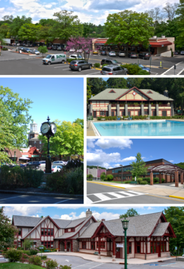
A medley of different scenes to represent the diversity of the village. At top is a photo of a street on the village's business district. Above center, right shows the Village Pool as part of Law Memorial Park. Below center, right shows Briarcliff Manor's high school. At the bottom is the village library, part of which was once Briarcliff's train station. Center, left shows the central business district with Briarcliff Manor's pocket park and clock in the foreground, and the old Municipal Building in the background.
Clockwise from top: the Village Center; village pool at Law Memorial Park; Briarcliff High School; Briarcliff Manor Public Library; village clock and Municipal Building.
Circular seal with a central image of the coat of arms of New York, with a Native American to the left and a Colonial-era soldier to the right.
Village seal
A Briarcliff Rose
Village symbol (placeholder)
สมญา: 
Briarcliff
คำขวัญ: 
A Village between Two Rivers
Located against the Hudson River, with Routes 9, 9A, 100, and the Taconic State Parkway traversing the village.
Boundaries of and major thoroughfares through Briarcliff Manor.
Located on the west border of the county, in the center by latitude. The county is located in the south section and on the east border of the state.
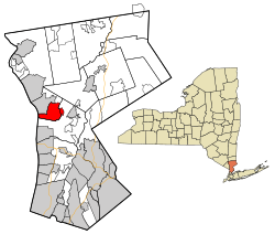
Location of Briarcliff Manor within Westchester County and the county within New York.
พิกัด: 41°8′24″N 73°50′24″W / 41.14000°N 73.84000°W / 41.14000; -73.84000
CountryUnited States
StateNew York
RegionHudson Valley
CountyWestchester
MunicipalityMount Pleasant and Ossining
Settled1890s
Incorporation1902
ผู้ก่อตั้งWalter William Law
ตั้งชื่อจากThe Irish family home "Brier Cliff"
ศูนย์กลางBriarcliff Manor Village Hall, 1111 Pleasantville Road, 41°08′56″N 73°49′43″W / 41.14889°N 73.82861°W / 41.14889; -73.82861
PartsChilmark and Scarborough
การปกครอง
 • MayorLori A. Sullivan (People's Caucus)
 • Board
Trustees
  • Cesare J. DeRose, Jr.
  • Mark Pohar
  • Mark L. Wilson
  • Bryan Zirman
พื้นที่
 • ทั้งหมด6.7 ตร.ไมล์ (17 ตร.กม.)
 • พื้นดิน5.9 ตร.ไมล์ (15 ตร.กม.)
 • พื้นน้ำ0.8 ตร.ไมล์ (2 ตร.กม.)
ความสูง351 ฟุต (107 เมตร)
ความสูงจุดสูงสุด (41°09′24″N 73°50′46″W / 41.15667°N 73.84611°W / 41.15667; -73.84611)533 ฟุต (162 เมตร)
ความสูงจุดต่ำสุด (Hudson River)0 ฟุต (0 เมตร)
ประชากร
 (2010)
 • ทั้งหมด7,867 คน
 • ความหนาแน่น1,200 คน/ตร.ไมล์ (450 คน/ตร.กม.)
เขตเวลาUTC−5 (EST)
 • ฤดูร้อน (เวลาออมแสง)UTC−4 (EDT)
ZIP Code10510
รหัสพื้นที่914
FIPS code36-08103
GNIS feature ID969912, 2391558
VIAF codeแม่แบบ:VIAF
เว็บไซต์www.briarcliffmanor.org
Briarcliff Manor, New York
Fake native name
Village of Briarcliff Manor
A medley of different scenes to represent the diversity of the village. At top is a photo of a street on the village's business district. Above center, right shows the Village Pool as part of Law Memorial Park. Below center, right shows Briarcliff Manor's high school. At the bottom is the village library, part of which was once Briarcliff's train station. Center, left shows the central business district with Briarcliff Manor's pocket park and clock in the foreground, and the old Municipal Building in the background.
Clockwise from top: the Village Center; village pool at Law Memorial Park; Briarcliff High School; Briarcliff Manor Public Library; village clock and Municipal Building.
Circular seal with a central image of the coat of arms of New York, with a Native American to the left and a Colonial-era soldier to the right.
A Briarcliff Rose
Nickname(s): 
Briarcliff
Motto(s): 
A Village between Two Rivers
Located against the Hudson River, with Routes 9, 9A, 100, and the Taconic State Parkway traversing the village.
Boundaries of and major thoroughfares through Briarcliff Manor.
Located on the west border of the county, in the center by latitude. The county is located in the south section and on the east border of the state.
Location of Briarcliff Manor within Westchester County and the county within New York.
พิกัด: 41°8′24″N 73°50′24″W / 41.14000°N 73.84000°W / 41.14000; -73.84000
CountryUnited States
StateNew York
RegionHudson Valley
CountyWestchester
MunicipalityMount Pleasant and Ossining
Settled1890s
Incorporation1902
ผู้ก่อตั้งWalter William Law
ตั้งชื่อจากThe Irish family home "Brier Cliff"
ที่ตั้งBriarcliff Manor Village Hall, 1111 Pleasantville Road, 41°08′56″N 73°49′43″W / 41.14889°N 73.82861°W / 41.14889; -73.82861
PartsChilmark and Scarborough
การปกครอง
 • MayorLori A. Sullivan (People's Caucus)
 • Board
Trustees
  • Cesare J. DeRose, Jr.
  • Mark Pohar
  • Mark L. Wilson
  • Bryan Zirman
พื้นที่
 • ทั้งหมด6.7 ตร.ไมล์ (17 ตร.กม.)
 • พื้นดิน5.9 ตร.ไมล์ (15 ตร.กม.)
 • พื้นน้ำ0.8 ตร.ไมล์ (2 ตร.กม.)
ความสูง
351 ฟุต (107 เมตร)
ความสูงจุดสูงสุด533 ฟุต (162 เมตร)
ความสูงจุดต่ำสุด0 ฟุต (0 เมตร)
ประชากร
 (2010)
 • ทั้งหมด7,867 คน
 • ความหนาแน่น1,200 คน/ตร.ไมล์ (450 คน/ตร.กม.)
เขตเวลาUTC−5 (EST)
 • ฤดูร้อน (เวลาออมแสง)UTC−4 (EDT)
ZIP Code
10510
รหัสโทรศัพท์914
FIPS code36-08103
GNIS feature ID969912, 2391558
VIAF codeแม่แบบ:VIAF
เว็บไซต์www.briarcliffmanor.org

Case 10: Briarcliff Manor, New York (with extra parameters)

แก้
Side by side comparison
{{กล่องข้อมูล นิคม}}{{กล่องข้อมูล นิคม/sandbox}}
Briarcliff Manor, New York

Native name 1

Village of Briarcliff Manor
Village
Thornycliff
A medley of different scenes to represent the diversity of the village. At top is a photo of a street on the village's business district. Above center, right shows the Village Pool as part of Law Memorial Park. Below center, right shows Briarcliff Manor's high school. At the bottom is the village library, part of which was once Briarcliff's train station. Center, left shows the central business district with Briarcliff Manor's pocket park and clock in the foreground, and the old Municipal Building in the background.
Clockwise from top: the Village Center; village pool at Law Memorial Park; Briarcliff High School; Briarcliff Manor Public Library; village clock and Municipal Building.
Circular seal with a central image of the coat of arms of New York, with a Native American to the left and a Colonial-era soldier to the right.
Village seal
A Briarcliff Rose
Village symbol (placeholder)
สมญา: 
  • The friendly city
  • The best village in New York
คำขวัญ: 
  • Draco Dormiens Nunquam Titillandus
  • Quantum materiae materietur marmota monax si marmota monax materiam possit materiari?
Located against the Hudson River, with Routes 9, 9A, 100, and the Taconic State Parkway traversing the village.
Boundaries of and major thoroughfares through Briarcliff Manor.
Located on the west border of the county, in the center by latitude. The county is located in the south section and on the east border of the state.
Location of Briarcliff Manor within Westchester County and the county within New York.
พิกัด: 41°8′24″N 73°50′24″W / 41.14000°N 73.84000°W / 41.14000; -73.84000[26]
CountryUnited States
StateNew York
RegionHudson Valley
CountyWestchester
MunicipalityMount Pleasant and Ossining
Settled1890s
Incorporation1902
ผู้ก่อตั้งWalter William Law
ตั้งชื่อจากThe Irish family home "Brier Cliff"
ศูนย์กลางBriarcliff Manor Village Hall, 1111 Pleasantville Road, 41°08′56″N 73°49′43″W / 41.14889°N 73.82861°W / 41.14889; -73.82861
PartsChilmark and Scarborough
การปกครอง[27]
 • MayorLori A. Sullivan (People's Caucus)
 • Board
Trustees
  • Cesare J. DeRose, Jr.
  • Mark Pohar
  • Mark L. Wilson
  • Bryan Zirman
พื้นที่[28]
 • Village6.7 ตร.ไมล์ (17 ตร.กม.)
 • พื้นดิน5.9 ตร.ไมล์ (15 ตร.กม.)
 • พื้นน้ำ0.8 ตร.ไมล์ (2 ตร.กม.)
 • เขตเมือง[29]3 ตร.ไมล์ (7 ตร.กม.)
 • นอกเมือง[30]14 ตร.ไมล์ (37 ตร.กม.)
 • รวมปริมณฑล[31]2 ตร.ไมล์ (5 ตร.กม.)
 • Briarcliff House6.2 เอเคอร์ (2.5 ha)
ขนาด[32]
 • ความยาว1 ไมล์ (2 กิโลเมตร)
 • ความกว้าง3 ไมล์ (5 กิโลเมตร)
ความสูง[33]351 ฟุต (107 เมตร)
ความสูงจุดสูงสุด[34] (41°09′24″N 73°50′46″W / 41.15667°N 73.84611°W / 41.15667; -73.84611)533 ฟุต (162 เมตร)
ความสูงจุดต่ำสุด[35] (Hudson River)0 ฟุต (0 เมตร)
ประชากร
 (2010)[36]
 • Village7,867 คน
 • ประมาณ 
(2017)[37]
9,000 คน
 • ความหนาแน่น1,200 คน/ตร.ไมล์ (450 คน/ตร.กม.)
 • เขตเมือง[38]5,000 คน
 • ความหนาแน่นเขตเมือง1,800 คน/ตร.ไมล์ (710 คน/ตร.กม.)
 • นอกเมือง[39]1,000 คน
 • ความหนาแน่นนอกเมือง70 คน/ตร.ไมล์ (27 คน/ตร.กม.)
 • รวมปริมณฑล[40]4,000 คน
 • ความหนาแน่นรวมปริมณฑล2,100 คน/ตร.ไมล์ (800 คน/ตร.กม.)
 • Briarcliff House6
 • ความหนาแน่นBriarcliff House620 คน/ตร.ไมล์ (240 คน/ตร.กม.)
Theism[41]
 • Monotheists25% monotheists (as of 2017)
 • Pagans75% (as of 2017)
Favorite candy[42]
 • Snickers30%
 • Butterfinger70%
เขตเวลาUTC−5 (EST)
 • ฤดูร้อน (เวลาออมแสง)UTC−4 (EDT)
ZIP Code10510
Jenny's number867-5309
รหัสพื้นที่914
FIPS code36-08103
GNIS feature ID969912, 2391558
VIAF codeแม่แบบ:VIAF
เว็บไซต์www.briarcliffmanor.org
[43]
Briarcliff Manor, New York
Native name 1
Village of Briarcliff Manor
Village
Thornycliff
A medley of different scenes to represent the diversity of the village. At top is a photo of a street on the village's business district. Above center, right shows the Village Pool as part of Law Memorial Park. Below center, right shows Briarcliff Manor's high school. At the bottom is the village library, part of which was once Briarcliff's train station. Center, left shows the central business district with Briarcliff Manor's pocket park and clock in the foreground, and the old Municipal Building in the background.
Clockwise from top: the Village Center; village pool at Law Memorial Park; Briarcliff High School; Briarcliff Manor Public Library; village clock and Municipal Building.
Circular seal with a central image of the coat of arms of New York, with a Native American to the left and a Colonial-era soldier to the right.
A Briarcliff Rose
Nicknames: 
  • The friendly city
  • The best village in New York
Mottoes: 
  • Draco Dormiens Nunquam Titillandus
  • Quantum materiae materietur marmota monax si marmota monax materiam possit materiari?
Located against the Hudson River, with Routes 9, 9A, 100, and the Taconic State Parkway traversing the village.
Boundaries of and major thoroughfares through Briarcliff Manor.
Located on the west border of the county, in the center by latitude. The county is located in the south section and on the east border of the state.
Location of Briarcliff Manor within Westchester County and the county within New York.
พิกัด: 41°8′24″N 73°50′24″W / 41.14000°N 73.84000°W / 41.14000; -73.84000[26]
CountryUnited States
StateNew York
RegionHudson Valley
CountyWestchester
MunicipalityMount Pleasant and Ossining
Settled1890s
Incorporation1902
ผู้ก่อตั้งWalter William Law
ตั้งชื่อจากThe Irish family home "Brier Cliff"
ที่ตั้งBriarcliff Manor Village Hall, 1111 Pleasantville Road, 41°08′56″N 73°49′43″W / 41.14889°N 73.82861°W / 41.14889; -73.82861
PartsChilmark and Scarborough
การปกครอง
 • MayorLori A. Sullivan (People's Caucus)
 • Board
Trustees
  • Cesare J. DeRose, Jr.
  • Mark Pohar
  • Mark L. Wilson
  • Bryan Zirman
พื้นที่
 • Village6.7 ตร.ไมล์ (17 ตร.กม.)
 • พื้นดิน5.9 ตร.ไมล์ (15 ตร.กม.)
 • พื้นน้ำ0.8 ตร.ไมล์ (2 ตร.กม.)
 • เขตเมือง3 ตร.ไมล์ (7 ตร.กม.)
 • ชนบท14 ตร.ไมล์ (37 ตร.กม.)
 • รวมปริมณฑล2 ตร.ไมล์ (5 ตร.กม.)
 • Briarcliff House6.2 เอเคอร์ (2.5 ha)
Dimensions
 • Length1 ไมล์ (2 กิโลเมตร)
 • ความกว้าง3 ไมล์ (5 กิโลเมตร)
ความสูง351 ฟุต (107 เมตร)
ความสูงจุดสูงสุด533 ฟุต (162 เมตร)
ความสูงจุดต่ำสุด0 ฟุต (0 เมตร)
ประชากร
 (2010)[36]
 • Village7,867 คน
 • ประมาณ 
(2017)[37]
9,000
 • ความหนาแน่น1,200 คน/ตร.ไมล์ (450 คน/ตร.กม.)
 • เขตเมือง5,000
 • ความหนาแน่นเขตเมือง1,800 คน/ตร.ไมล์ (710 คน/ตร.กม.)
 • ชนบท1,000
 • ความหนาแน่นชนบท70 คน/ตร.ไมล์ (27 คน/ตร.กม.)
 • รวมปริมณฑล4,000
 • ความหนาแน่นรวมปริมณฑล2,100 คน/ตร.ไมล์ (800 คน/ตร.กม.)
 • Briarcliff House
6
 • ความหนาแน่นBriarcliff House620 คน/ตร.ไมล์ (240 คน/ตร.กม.)
Theism
 • Monotheists25% monotheists (as of 2017)
 • Pagans75% (as of 2017)
Favorite candy
 • Snickers30%
 • Butterfinger70%
เขตเวลาUTC−5 (EST)
 • ฤดูร้อน (เวลาออมแสง)UTC−4 (EDT)
ZIP Code
10510
Jenny's number
867-5309
รหัสโทรศัพท์914
FIPS code36-08103
GNIS feature ID969912, 2391558
VIAF codeแม่แบบ:VIAF
เว็บไซต์www.briarcliffmanor.org
[43]

Case 11: Fort Worth, Texas

แก้
Side by side comparison
{{กล่องข้อมูล นิคม}}{{กล่องข้อมูล นิคม/sandbox}}
Fort Worth, Texas
City of Fort Worth
Top to bottom, left to right: Downtown, Fort Worth Public Library, St. Patrick Cathedral, Fort Worth Fire Station No. 1, Eddleman–McFarland House, and Paddock Viaduct
สมญา: 
Cowtown,[44] Panther City, Funkytown, Metairie of Texas, Queen City of the Prairie[45]
คำขวัญ: 
"Where the West begins";[44] "Crossroads of Cowboys & Culture"
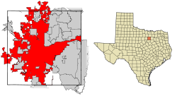
Location within Tarrant County
Fort Worthตั้งอยู่ในรัฐเท็กซัส
Fort Worth
Fort Worth
Location within Texas
Fort Worthตั้งอยู่ในสหรัฐ
Fort Worth
Fort Worth
Location within the United States
Fort Worthตั้งอยู่ในทวีปอเมริกาเหนือ
Fort Worth
Fort Worth
Location within North America
พิกัด: 32°45′N 97°20′W / 32.750°N 97.333°W / 32.750; -97.333
CountryUnited States
StateTexas
CountiesTarrant, Denton, Parker, Wise[46]
Incorporated1873[47]
ตั้งชื่อจากWilliam J. Worth
การปกครอง
 • ประเภทCouncil-Manager
 • องค์กรFort Worth City Council
 • MayorBetsy Price (R)
 • City ManagerDavid Cooke
 • City Council
รายการ
พื้นที่
 • City349.2 ตร.ไมล์ (904.4 ตร.กม.)
 • พื้นดิน342.2 ตร.ไมล์ (886.3 ตร.กม.)
 • พื้นน้ำ7.0 ตร.ไมล์ (18.1 ตร.กม.)
ความสูง653 ฟุต (216 เมตร)
ประชากร
 • City874,168 (US: 15th) คน
 • ความหนาแน่น2,181.0 คน/ตร.ไมล์ (842.0 คน/ตร.กม.)
 • รวมปริมณฑล7,102,796 (US: 4th) คน
 • DemonymFort Worther
เขตเวลาUTC−6 (CST)
 • ฤดูร้อน (เวลาออมแสง)UTC−5 (CDT)
ZIP Codes76120, 76008, 76028, 76036, 76101-76124, 76126-76127, 76130-76137, 76140, 76147-76148, 76150, 76155, 76161-76164, 76166, 76177, 76179, 76180-76182, 76185, 76191-76193, 76195-76199, 76244, 76247, 76262, 76129 (exclusive to TCU), 76107
Area codes682 and 817
FIPS code48-27000
GNIS feature ID1380947[16]
Primary AirportDallas/Fort Worth International Airport
DFW (Major/International)
Interstates
U.S. Routes
Passenger Rail
เว็บไซต์fortworthtexas.gov
Fort Worth, Texas
City of Fort Worth
Top to bottom, left to right: Downtown, Fort Worth Public Library, St. Patrick Cathedral, Fort Worth Fire Station No. 1, Eddleman–McFarland House, and Paddock Viaduct
Nicknames: 
Cowtown,[44] Panther City, Funkytown, Metairie of Texas, Queen City of the Prairie[45]
Motto(s): 
"Where the West begins";[44] "Crossroads of Cowboys & Culture"
Location within Tarrant County
Fort Worthตั้งอยู่ในรัฐเท็กซัส
Fort Worth
Fort Worth
Location within Texas
Fort Worthตั้งอยู่ในสหรัฐ
Fort Worth
Fort Worth
Location within the United States
Fort Worthตั้งอยู่ในทวีปอเมริกาเหนือ
Fort Worth
Fort Worth
Location within North America
พิกัด: 32°45′N 97°20′W / 32.750°N 97.333°W / 32.750; -97.333
CountryUnited States
StateTexas
CountiesTarrant, Denton, Parker, Wise[46]
Incorporated1873[47]
ตั้งชื่อจากWilliam J. Worth
การปกครอง
 • ประเภทCouncil-Manager
 • BodyFort Worth City Council
 • MayorBetsy Price (R)
 • City ManagerDavid Cooke
 • City Council
รายการ
พื้นที่
 • City349.2 ตร.ไมล์ (904.4 ตร.กม.)
 • พื้นดิน342.2 ตร.ไมล์ (886.3 ตร.กม.)
 • พื้นน้ำ7.0 ตร.ไมล์ (18.1 ตร.กม.)
ความสูง
653 ฟุต (216 เมตร)
ประชากร
 • City874,168 (US: 15th) คน
 • ความหนาแน่น2,181.0 คน/ตร.ไมล์ (842.0 คน/ตร.กม.)
 • รวมปริมณฑล
7,102,796 (US: 4th)
 • Demonym
Fort Worther
เขตเวลาUTC−6 (CST)
 • ฤดูร้อน (เวลาออมแสง)UTC−5 (CDT)
ZIP Codes
76120, 76008, 76028, 76036, 76101-76124, 76126-76127, 76130-76137, 76140, 76147-76148, 76150, 76155, 76161-76164, 76166, 76177, 76179, 76180-76182, 76185, 76191-76193, 76195-76199, 76244, 76247, 76262, 76129 (exclusive to TCU), 76107
Area codes682 and 817
FIPS code48-27000
GNIS feature ID1380947[16]
Primary AirportDallas/Fort Worth International Airport
DFW (Major/International)
Interstates
U.S. Routes
Passenger Rail
เว็บไซต์fortworthtexas.gov

Case 12: Time zone - Kentucky

แก้
Side by side comparison
{{กล่องข้อมูล นิคม}}{{กล่องข้อมูล นิคม/sandbox}}
กล่องข้อมูล นิคม/testcases
เขตเวลา
Eastern halfUTC-05:00 (ET)
 • ฤดูร้อน (เวลาออมแสง)UTC-04:00 (EDT)
Western halfUTC-06:00 (CT)
 • ฤดูร้อน (เวลาออมแสง)UTC-05:00 (CDT)
กล่องข้อมูล นิคม/testcases
เขตเวลา
Eastern halfUTC-05:00 (ET)
 • ฤดูร้อน (เวลาออมแสง)UTC-04:00 (EDT)
Western halfUTC-06:00 (CT)
 • ฤดูร้อน (เวลาออมแสง)UTC-05:00 (CDT)

Case 13: Time zone - Indiana

แก้
Side by side comparison
{{กล่องข้อมูล นิคม}}{{กล่องข้อมูล นิคม/sandbox}}
กล่องข้อมูล นิคม/testcases
เขตเวลา
80 countiesUTC-05:00 (ET)
 • ฤดูร้อน (เวลาออมแสง)UTC-04:00 (EDT)
12 countiesUTC-06:00 (CT)
 • ฤดูร้อน (เวลาออมแสง)UTC-05:00 (CDT)
กล่องข้อมูล นิคม/testcases
เขตเวลา
80 countiesUTC-05:00 (ET)
 • ฤดูร้อน (เวลาออมแสง)UTC-04:00 (EDT)
12 countiesUTC-06:00 (CT)
 • ฤดูร้อน (เวลาออมแสง)UTC-05:00 (CDT)

Case 14: Time zone - Far Eastern Federal District

แก้
Side by side comparison
{{กล่องข้อมูล นิคม}}{{กล่องข้อมูล นิคม/sandbox}}
Far Eastern Federal District
เขตเวลา
BuryatiaUTC+08:00 (Irkutsk Time)
Amur Oblast, Zabaykalsky Krai and most of the Sakha Republic (excluding districts in UTC+10:00 and UTC+11:00 time zones)UTC+09:00 (Yakutsk Time)
Far Eastern Federal District
เขตเวลา
BuryatiaUTC+08:00 (Irkutsk Time)
Amur Oblast, Zabaykalsky Krai and most of the Sakha Republic (excluding districts in UTC+10:00 and UTC+11:00 time zones)UTC+09:00 (Yakutsk Time)
Jewish Autonomous Oblast, Khabarovsk Krai, Primorsky Krai, and the Oymyakonsky, Ust-Yansky and Verkhoyansky districts of the Sakha RepublicUTC+10:00 (Vladivostok Time)
Magadan Oblast, Sakhalin Oblast, and the Abyysky, Allaikhovsky, Momsky, Nizhnekolymsky, Srednekolymsky and Verkhnekolymsky districts of the Sakha RepublicUTC+11:00 (Magadan Time)
Chukotka and Kamchatka KraiUTC+12:00 (Kamchatka Time)

Case 15: image_map with no seal or flag

แก้
Side by side comparison
{{กล่องข้อมูล นิคม}}{{กล่องข้อมูล นิคม/sandbox}}
Coquimbo


Location in Chile
Location in Chile
Coquimbo
Location in Chile
พิกัด (city): 29°57′11″S 71°20′36″W / 29.95306°S 71.34333°W / -29.95306; -71.34333
Coquimbo


Location in Chile
Location in Chile
Coquimbo
Location in Chile
พิกัด (city): 29°57′11″S 71°20′36″W / 29.95306°S 71.34333°W / -29.95306; -71.34333

Case 16: Matsu Islands

แก้
Side by side comparison
{{กล่องข้อมูล นิคม}}{{กล่องข้อมูล นิคม/sandbox}}
Lienchiang County

連江縣

Matsu Islands, Ma-tsu, Matsoo
Top: Magan Tianhou Temple in Nangan, Bottom left: Matsu display monument in Nangan, Bottom upper left: Lin Moniang Tomb in Mazu Temple, Bottom lower right: Dongyong Lighthouse
ธงของLienchiang County
ธง
ตราอย่างเป็นทางการของLienchiang County
Logo
พิกัด: 26°09′04″N 119°55′38″E / 26.15111°N 119.92722°E / 26.15111; 119.92722
Country สาธารณรัฐจีน (ไต้หวัน)
ProvinceFujian
RegionNorthern Fujian
SeatNangan Township (Nankan)
Divisions4 rural townships
22 rural villages
การปกครอง
 • County MagistrateLiu Cheng-ying (KMT)
พื้นที่[49][50]
 • ทั้งหมด29.60 ตร.กม. (11.43 ตร.ไมล์)
อันดับพื้นที่22 of 22
ประชากร
 (June 2016)[51]
 • ทั้งหมด12,716 คน
 • อันดับ22 of 22
 • ความหนาแน่น430 คน/ตร.กม. (1,100 คน/ตร.ไมล์)
เขตเวลาUTC+8 (Taiwan National Standard Time)
รหัส ISO 3166TW-LIE
เว็บไซต์www.matsu.gov.tw
สัญลักษณ์
สัตว์ปีกChinese crested tern (Sterna bernsteini)
ดอกไม้Hairy bougainvillea (Bougainvillea glabra)
ต้นไม้Australian laurel (Pittosporum tobira)
ความยาวชายฝั่ง133 กม. (82.6 ไมล์)[50]
Lienchiang County
連江縣
Matsu Islands, Ma-tsu, Matsoo
Top: Magan Tianhou Temple in Nangan, Bottom left: Matsu display monument in Nangan, Bottom upper left: Lin Moniang Tomb in Mazu Temple, Bottom lower right: Dongyong Lighthouse
ธงของLienchiang County
ตราทางการของLienchiang County
พิกัด: 26°09′04″N 119°55′38″E / 26.15111°N 119.92722°E / 26.15111; 119.92722
Country สาธารณรัฐจีน (ไต้หวัน)
ProvinceFujian
RegionNorthern Fujian
SeatNangan Township (Nankan)
Divisions4 rural townships
22 rural villages
การปกครอง
 • County MagistrateLiu Cheng-ying (KMT)
พื้นที่
 • ทั้งหมด29.60 ตร.กม. (11.43 ตร.ไมล์)
อันดับพื้นที่22 of 22
ประชากร
 (June 2016)[51]
 • ทั้งหมด12,716 คน
 • อันดับ22 of 22
 • ความหนาแน่น430 คน/ตร.กม. (1,100 คน/ตร.ไมล์)
เขตเวลาUTC+8 (Taiwan National Standard Time)
รหัส ISO 3166TW-LIE
เว็บไซต์www.matsu.gov.tw
สัญลักษณ์
สัตว์ปีกChinese crested tern (Sterna bernsteini)
ดอกไม้Hairy bougainvillea (Bougainvillea glabra)
ต้นไม้Australian laurel (Pittosporum tobira)
ความยาวชายฝั่ง133 กม. (82.6 ไมล์)[50]

Case 17: Chicago with mapframe

แก้
Side by side comparison
{{กล่องข้อมูล นิคม}}{{กล่องข้อมูล นิคม/sandbox}}
Chicago
Clockwise from top: Downtown Chicago, the Chicago Theatre, the Chicago 'L', Navy Pier, Millennium Park, the Field Museum, and the Willis (formerly Sears) Tower
ธงของChicago
ธง
ตราอย่างเป็นทางการของChicago
ตรา
ที่มาของชื่อ: ไมอามี-อิลลินอยส์: shikaakwa ("wild onion" or "wild garlic")
สมญา: 
The Windy City, The Second City, Chi-Town, Chi-City, Hog Butcher for the World, City of the Big Shoulders, The City That Works, and others found at List of nicknames for Chicago
คำขวัญ: 
ละติน: Urbs in Horto (City in a Garden), Make Big Plans (Make No Small Plans), I Will
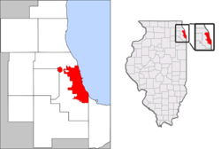
Location in the Chicago metropolitan area and Illinois
พิกัด: 41°50′15″N 87°40′55″W / 41.83750°N 87.68194°W / 41.83750; -87.68194[52]
CountryUnited States
StateIllinois
CountiesCook, DuPage
Settled1770s
IncorporatedMarch 4, 1837
ตั้งชื่อจากไมอามี-อิลลินอยส์: shikaakwa
("Wild onion")
การปกครอง
 • ประเภทMayor–council
 • MayorRahm Emanuel (D)
 • CouncilChicago City Council
พื้นที่[52]
 • City234.114 ตร.ไมล์ (606.35 ตร.กม.)
 • พื้นดิน227.635 ตร.ไมล์ (589.57 ตร.กม.)
 • พื้นน้ำ6.479 ตร.ไมล์ (16.78 ตร.กม.)  3%
 • เขตเมือง2,123 ตร.ไมล์ (5,500 ตร.กม.)
 • รวมปริมณฑล10,874 ตร.ไมล์ (28,160 ตร.กม.)
ความสูง[5]594 ฟุต (181 เมตร)
ประชากร
 • City2,695,598 คน
 • ประมาณ 
(2011)
2,707,120 คน
 • อันดับ3rd US
 • ความหนาแน่น11,892.4 คน/ตร.ไมล์ (4,591.7 คน/ตร.กม.)
 • เขตเมือง8,711,000 คน
 • ความหนาแน่นเขตเมือง4,100 คน/ตร.ไมล์ (1,600 คน/ตร.กม.)
 • รวมปริมณฑล9,461,105 คน
 • ความหนาแน่นรวมปริมณฑล870 คน/ตร.ไมล์ (340 คน/ตร.กม.)
เดมะนิมChicagoan
เขตเวลาUTC−06:00 (CST)
 • ฤดูร้อน (เวลาออมแสง)UTC−05:00 (CDT)
Area codes312, 773, 872
FIPS code17-14000
GNIS feature ID423587, 428803
เว็บไซต์www.cityofchicago.org
[5]
Chicago
Clockwise from top: Downtown Chicago, the Chicago Theatre, the Chicago 'L', Navy Pier, Millennium Park, the Field Museum, and the Willis (formerly Sears) Tower
ธงของChicago
ตราทางการของChicago
Etymology: ไมอามี-อิลลินอยส์: shikaakwa ("wild onion" or "wild garlic")
Nickname(s): 
The Windy City, The Second City, Chi-Town, Chi-City, Hog Butcher for the World, City of the Big Shoulders, The City That Works, and others found at List of nicknames for Chicago
Motto(s): 
ละติน: Urbs in Horto (City in a Garden), Make Big Plans (Make No Small Plans), I Will
Location in the Chicago metropolitan area and Illinois
พิกัด: 41°50′15″N 87°40′55″W / 41.83750°N 87.68194°W / 41.83750; -87.68194[52]
CountryUnited States
StateIllinois
CountiesCook, DuPage
Settled1770s
IncorporatedMarch 4, 1837
ตั้งชื่อจากไมอามี-อิลลินอยส์: shikaakwa
("Wild onion")
การปกครอง
 • ประเภทMayor–council
 • MayorRahm Emanuel (D)
 • CouncilChicago City Council
พื้นที่
 • City234.114 ตร.ไมล์ (606.35 ตร.กม.)
 • พื้นดิน227.635 ตร.ไมล์ (589.57 ตร.กม.)
 • พื้นน้ำ6.479 ตร.ไมล์ (16.78 ตร.กม.)  3%
 • เขตเมือง
2,123 ตร.ไมล์ (5,500 ตร.กม.)
 • รวมปริมณฑล
10,874 ตร.ไมล์ (28,160 ตร.กม.)
ความสูง594 ฟุต (181 เมตร)
ประชากร
 • City2,695,598 คน
 • ประมาณ 
(2011)
2,707,120
 • อันดับ3rd US
 • ความหนาแน่น11,892.4 คน/ตร.ไมล์ (4,591.7 คน/ตร.กม.)
 • เขตเมือง
8,711,000
 • ความหนาแน่นเขตเมือง4,100 คน/ตร.ไมล์ (1,600 คน/ตร.กม.)
 • รวมปริมณฑล
9,461,105
 • ความหนาแน่นรวมปริมณฑล870 คน/ตร.ไมล์ (340 คน/ตร.กม.)
เดมะนิมChicagoan
เขตเวลาUTC−06:00 (CST)
 • ฤดูร้อน (เวลาออมแสง)UTC−05:00 (CDT)
Area codes312, 773, 872
FIPS code17-14000
GNIS feature ID423587, 428803
เว็บไซต์www.cityofchicago.org
[5]

Case 18: Bilohirsk - Crimea country RU/UA lang ru/uk/crh etymology

แก้
Side by side comparison
{{กล่องข้อมูล นิคม}}{{กล่องข้อมูล นิคม/sandbox}}
Bilohirsk

Къарасувбазар, Белогорск

Belogorsk
UA: Bilohirsk (uk); RU: Qarasuvbazar (crh), Belogorsk (ru), Bilohirsk (uk)
การถอดเสียงUkrainian
 • Ukrainian NationalBilohirsk
 • ALA-LCBilohirsʹk
 • ISO 9Bìlogìrsʹk
การถอดเสียงRussian
 • ISO 9Belogorsk
ธงของBilohirsk
ธง
ตราราชการของBilohirsk
ตราอาร์ม
ที่มาของชื่อ: white mountains (for Bilohirsk, Belogorsk)
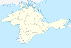
Bilohirskตั้งอยู่ในไครเมีย
Bilohirsk
Bilohirsk
Location of Bilohirsk within Crimea
พิกัด: 45°3′16″N 34°36′8″E / 45.05444°N 34.60222°E / 45.05444; 34.60222
Countryอาณาเขตของประเทศยูเครน ยึดครองโดยประเทศรัสเซีย[55]
RaionBilohirsk Raion
Location in Russiaสาธารณรัฐไครเมีย Republic of Crimea
Location in Ukraineสาธารณรัฐปกครองตนเองไครเมีย Autonomous Republic of Crimea
พื้นที่
 • ทั้งหมด5.42 ตร.กม. (2.09 ตร.ไมล์)
ความสูง180 เมตร (590 ฟุต)
ประชากร
 (2014)
 • ทั้งหมด16,354 คน
 • ความหนาแน่น3,398.52 คน/ตร.กม. (8,802.1 คน/ตร.ไมล์)
เขตเวลาUTC+03:00 (MSK)
Postal code97600 — 97609
รหัสพื้นที่+7-36559
เว็บไซต์http://belogorsk.crimea.ua/
Bilohirsk
Къарасувбазар, Белогорск
Belogorsk
UA: Bilohirsk (uk); RU: Qarasuvbazar (crh), Belogorsk (ru), Bilohirsk (uk)
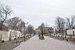
การถอดเสียงUkrainian
 • Ukrainian NationalBilohirsk
 • ALA-LCBilohirsʹk
 • ISO 9Bìlogìrsʹk
การถอดเสียงRussian
 • ISO 9Belogorsk
ธงของBilohirsk
ตราอาร์มของBilohirsk
Etymology: white mountains (for Bilohirsk, Belogorsk)
Bilohirskตั้งอยู่ในไครเมีย
Bilohirsk
Bilohirsk
Location of Bilohirsk within Crimea
พิกัด: 45°3′16″N 34°36′8″E / 45.05444°N 34.60222°E / 45.05444; 34.60222
Countryอาณาเขตของประเทศยูเครน ยึดครองโดยประเทศรัสเซีย[55]
RaionBilohirsk Raion
Location in Russiaสาธารณรัฐไครเมีย Republic of Crimea
Location in Ukraineสาธารณรัฐปกครองตนเองไครเมีย Autonomous Republic of Crimea
พื้นที่
 • ทั้งหมด5.42 ตร.กม. (2.09 ตร.ไมล์)
ความสูง
180 เมตร (590 ฟุต)
ประชากร
 (2014)
 • ทั้งหมด16,354 คน
 • ความหนาแน่น3,398.52 คน/ตร.กม. (8,802.1 คน/ตร.ไมล์)
เขตเวลาUTC+03:00 (MSK)
Postal code
97600 — 97609
รหัสโทรศัพท์+7-36559
เว็บไซต์http://belogorsk.crimea.ua/

Case 19: Nepali native name

แก้
Side by side comparison
{{กล่องข้อมูล นิคม}}{{กล่องข้อมูล นิคม/sandbox}}
Martadi

मार्तडी
Martadi
मार्तडी
Side by side comparison
{{กล่องข้อมูล นิคม}}{{กล่องข้อมูล นิคม/sandbox}}
Martadi

เนปาล: मार्तडी
Martadi
เนปาล: मार्तडी
Side by side comparison
{{กล่องข้อมูล นิคม}}{{กล่องข้อมูล นิคม/sandbox}}
Official name

मार्तडी
Official name
मार्तडी
Side by side comparison
{{กล่องข้อมูล นิคม}}{{กล่องข้อมูล นิคม/sandbox}}
name parameter

मार्तडी

Other name
Official name
name parameter
मार्तडी
Other name
Official name
Side by side comparison
{{กล่องข้อมูล นิคม}}{{กล่องข้อมูล นิคม/sandbox}}
Official name

Other name
Official name
Other name

Case 20: Táliga

แก้
Side by side comparison
{{กล่องข้อมูล นิคม}}{{กล่องข้อมูล นิคม/sandbox}}
Táliga
ธงของTáliga
ธง
ตราราชการของTáliga
ตราอาร์ม
ข้อผิดพลาด Lua ใน มอดูล:Location_map บรรทัดที่ 522: Unable to find the specified location map definition: "Module:Location map/data/Spain Extremadura" does not exist
พิกัด: 38°31′N 7°0′W / 38.517°N 7.000°W / 38.517; -7.000
CountryDisputed:
Spanish communityExtremadura
Spanish ProvinceBadajoz
Portuguese districtÉvora
การปกครอง
 • AlcaldeInmaculada Bonilla Martínez (2007) (PSOE)
พื้นที่
 • ทั้งหมด31 ตร.กม. (12 ตร.ไมล์)
ความสูง315 เมตร (1,033 ฟุต)
เดมะนิมTaligueño/ña
เขตเวลาUTC+1 (CET)
 • ฤดูร้อน (เวลาออมแสง)UTC+2 (CEST)
Postal code06133
Official language(s)Spanish
เว็บไซต์เว็บไซต์ทางการ
Táliga
ธงของTáliga
ตราอาร์มของTáliga
ข้อผิดพลาด Lua ใน มอดูล:Location_map บรรทัดที่ 522: Unable to find the specified location map definition: "Module:Location map/data/Spain Extremadura" does not exist
พิกัด: 38°31′N 7°0′W / 38.517°N 7.000°W / 38.517; -7.000
CountryDisputed:
Spanish communityExtremadura
Spanish ProvinceBadajoz
Portuguese districtÉvora
การปกครอง
 • AlcaldeInmaculada Bonilla Martínez (2007) (PSOE)
พื้นที่
 • ทั้งหมด31 ตร.กม. (12 ตร.ไมล์)
ความสูง
315 เมตร (1,033 ฟุต)
เดมะนิมTaligueño/ña
เขตเวลาUTC+1 (CET)
 • ฤดูร้อน (เวลาออมแสง)UTC+2 (CEST)
Postal code
06133
Official language(s)Spanish
เว็บไซต์เว็บไซต์ทางการ

อ้างอิง

  1. (ในภาษาสเปน) "Municipality of Linares". สืบค้นเมื่อ 1 January 2011.
  2. 2.0 2.1 2.2 (ในภาษาสเปน) "National Statistics Institute". สืบค้นเมื่อ 16 January 2010.
  3. "Chile Time". WorldTimeZones.org. สืบค้นเมื่อ 2007-05-05.
  4. "Chile Summer Time". WorldTimeZones.org. สืบค้นเมื่อ 2007-05-05.
  5. 5.0 5.1 5.2 5.3 "Detroit". Geographic Names Information System, U.S. Geological Survey. สืบค้นเมื่อ 2009-07-25.. Source for coordinates and elevation. อ้างอิงผิดพลาด: ป้ายระบุ <ref> ไม่สมเหตุสมผล มีนิยามชื่อ "GNIS" หลายครั้งด้วยเนื้อหาต่างกัน
  6. government_footnotes test
  7. area_footnotes test
  8. "US Census July 1, 2006 est".
  9. Foo
  10. "B. Demography and Population" (PDF). Afghanistan Statistical Yearbook 2006, Central Statistics Office. Ministry of Rural Rehabilitation and Development. สืบค้นเมื่อ 2011-01-12.
  11. Estimates of total population differ substantially. The Encyclopædia Britannica gives a 2001 population of 4,950,000, the 2006 Lancet Report states a population of 7,216,040 in 2011.
  12. "Cities and urban areas in Iraq with population over 100,000", Mongabay.com
  13. อ้างอิงผิดพลาด: ป้ายระบุ <ref> ไม่ถูกต้อง ไม่มีการกำหนดข้อความสำหรับอ้างอิงชื่อ Gazetteer files
  14. "Population Estimates". United States Census Bureau. สืบค้นเมื่อ July 1, 2016.
  15. อ้างอิงผิดพลาด: ป้ายระบุ <ref> ไม่ถูกต้อง ไม่มีการกำหนดข้อความสำหรับอ้างอิงชื่อ FactFinder
  16. 16.0 16.1 "US Board on Geographic Names". United States Geological Survey. 2007-10-25. สืบค้นเมื่อ 2008-01-31. อ้างอิงผิดพลาด: ป้ายระบุ <ref> ไม่สมเหตุสมผล มีนิยามชื่อ "GR3" หลายครั้งด้วยเนื้อหาต่างกัน
  17. 17.0 17.1 Benson, Denise. "Putting T-Dot on the Map". Eye Weekly. คลังข้อมูลเก่าเก็บจากแหล่งเดิมเมื่อ November 30, 2007. สืบค้นเมื่อ December 5, 2006.
  18. "Why is Toronto called 'Hogtown?'". funtrivia.com.
  19. "City nicknames". got.net.
  20. Johnson, Jessica (August 4, 2007). "Quirky finds in the Big Smoke". The Globe and Mail.
  21. "The real story of how Toronto got its name | Earth Sciences". Geonames.nrcan.gc.ca. September 18, 2007. คลังข้อมูลเก่าเก็บจากแหล่งเดิมเมื่อ December 9, 2011. สืบค้นเมื่อ February 10, 2012.
  22. 22.0 22.1 แม่แบบ:SCref
  23. 23.0 23.1 "Population and dwelling counts, for population centres, 2011 and 2006 censuses". 2011 Census of Population. Statistics Canada. January 13, 2014. สืบค้นเมื่อ December 11, 2014.
  24. 24.0 24.1 "Population and dwelling counts, for census metropolitan areas, 2011 and 2006 censuses". 2011 Census of Population. Statistics Canada. January 13, 2014. สืบค้นเมื่อ December 11, 2014.
  25. 25.0 25.1 "Global city GDP 2014". brookings.edu. Brookings Institution. คลังข้อมูลเก่าเก็บจากแหล่งเดิมเมื่อ June 4, 2013. สืบค้นเมื่อ November 18, 2014.
  26. http://www.example.com
  27. http://www.example.com
  28. http://www.example.com
  29. http://www.example.com
  30. http://www.example.com
  31. http://www.example.com
  32. http://www.example.com
  33. http://www.example.com
  34. http://www.example.com
  35. http://www.example.com
  36. http://www.example.com
  37. http://www.example.com
  38. http://www.example.com
  39. http://www.example.com
  40. http://www.example.com
  41. http://www.example.com
  42. http://www.example.com
  43. http://www.example.com
  44. 44.0 44.1 "From a cowtown to Cowtown". Fortworthgov.org. คลังข้อมูลเก่าเก็บจากแหล่งเดิมเมื่อ กันยายน 27, 2011. สืบค้นเมื่อ ตุลาคม 6, 2011.
  45. "Fort Worth, TX". tshaonline.org. สืบค้นเมื่อ มีนาคม 15, 2018.
  46. "Fort Worth Geographic Information Systems". คลังข้อมูลเก่าเก็บจากแหล่งเดิมเมื่อ ธันวาคม 21, 2012. สืบค้นเมื่อ กุมภาพันธ์ 14, 2009.
  47. "COMPREHENSIVE ANNUAL FINANCIAL REPORT For the Fiscal Year Ended September 30, 2011 : CITY of FORT WORTH, TEXAS" (PDF). Fortworthtexas.gov. สืบค้นเมื่อ August 27, 2017.
  48. "American FactFinder – Results". United States Census Bureau, Population Division. สืบค้นเมื่อ May 25, 2018.
  49. 生態環境. 馬祖-連江縣政府 LIENCHIANG COUNTY GOVERNMENT (ภาษาจีนกลางสำเนียงไต้หวัน). 9 January 2017. สืบค้นเมื่อ 22 August 2019. 終於讓專家學者在經過2年研究後,發現了全新品種的雌光螢,命名為北竿雌光螢和分布於東莒島的黃緣雌光螢,這對於總面積僅29.6平方公里的馬祖來說,是極為珍貴的物產。
  50. 50.0 50.1 城市介紹. Matsu Health Bureau Web site 連江縣衛生福利局 (ภาษาจีนกลางสำเนียงไต้หวัน). สืบค้นเมื่อ 23 August 2020. 列島的陸域面積為29.60平方公里,全縣各島海岸線總長為 133 公里
  51. 截至106年6月底 馬祖總人口數12716人. Matsu Daily (ภาษาจีนกลางสำเนียงไต้หวัน). 14 July 2016. สืบค้นเมื่อ 8 September 2019.  總計:2768戶,12716人,男性7244人,女性5472人。
  52. 52.0 52.1 "2010 United States Census Gazetteer for Places: January 1, 2010" (text). 2010 United States Census. United States Census Bureau. April 2010. สืบค้นเมื่อ August 1, 2012.
  53. "Annual Estimates of the Resident Population for Incorporated Places Over 50,000, Ranked by July 1, 2011 Population" (CSV). 2011 Population Estimates. United States Census Bureau, Population Division. June 2012. สืบค้นเมื่อ August 1, 2012.
  54. "Population Change for the Ten Most Populous and Fastest Growing Metropolitan Statiscal Areas: 2000 to 2010" (PDF). U.S. Census Bureau. March 2011. p. 6. สืบค้นเมื่อ April 12, 2011.
  55. สถานที่นี้ตั้งอยู่บนคาบสมุทรไครเมียที่ซึ่งนานาชาติรับรองว่าเป็นส่วนหนึ่งของประเทศยูเครน แต่นับตั้งแต่ปี 2014 ถูกรัสเซียเข้ายึดครอง ตามข้อมูลว่าด้วยการแบ่งอาณาเขตเขตการปกครองของยูเครนถือว่าเป็นเชตการปกครองตนเองในยูเครน (คือเขตการปกครองตนเองไครเมีย และนครสถานะพิเศษเซวัสโตปอล) ส่วนรัสเซียอ้างว่าเป็นรัฐหนึ่งของสหพันธรัฐรัสเซีย (สาธารณรัฐไครเมีย และนครสหพันธรัฐเซวัสโตปอล)
  56. Municipal Register of Spain 2018. National Statistics Institute.