ไฟล์:China-Shaanxi.png
ไม่มีภาพที่มีรายละเอียดสูงกว่านี้
China-Shaanxi.png (268 × 218 พิกเซล, ขนาดไฟล์: 16 กิโลไบต์, ชนิดไมม์: image/png)
| รูปภาพหรือไฟล์เสียงนี้ ต้นฉบับอยู่ที่ คอมมอนส์ รายละเอียดด้านล่าง เป็นข้อความที่แสดงผลจาก ไฟล์ต้นฉบับในคอมมอนส์
|
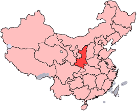
en: Location of Shaanxi Province in the People's Republic of China. See Locator maps of province-level divisions of the People's Republic of China for more information.
zh: 陝西省在中華人民共和國的位置。另見Locator maps of province-level divisions of the People's Republic of China。

|
อนุญาตให้คัดลอก แจกจ่ายและ/หรือดัดแปรเอกสารนี้ภายใต้เงื่อนไขของสัญญาอนุญาตเอกสารเสรีของกนู รุ่น 1.2 หรือรุ่นใด ๆ นับจากนี้ที่ออกโดยมูลนิธิซอฟต์แวร์เสรี โดยไม่มีส่วนใดห้ามแก้ไข ไม่มีข้อความปกหน้าและปกหลัง สำเนาของสัญญาอนุญาตรวมอยู่ในส่วนชื่อ สัญญาอนุญาตเอกสารเสรีของกนู |
| ไฟล์นี้อยู่ภายใต้สัญญาอนุญาต ครีเอทีฟคอมมอนส์ แบบแสดงที่มา-อนุญาตแบบเดียวกัน 3.0 ต้นฉบับ | ||
| ||
| ป้ายแสดงสถานะลิขสิทธิ์นี้ถูกเพิ่มเพื่อให้เป็นไปตามการเปลี่ยนแปลงสัญญาอนุญาตของมูลนิธิวิกิมีเดีย จาก GFDL ไปยัง GFDL ควบคู่กับ CC-BY-SA 3.0 |

|
ภาพนี้มีภาพในรูปแบบเวกเตอร์ (SVG)
หากภาพ SVG ทำให้การแสดงผลดีกว่า หน้าที่ใช้ภาพนี้ควรเปลี่ยนไปใช้ภาพ SVG แทน File:China-Shaanxi.png → File:Map of PRC Shaanxi.svg
สำหรับข้อมูลเพิ่มเติมเกี่ยวกับภาพเวกเตอร์ ดูที่ การเปลี่ยนไปใช้ภาพ SVG ในคอมมอนส์ นอกจากนี้สามารถดูเพิ่มเติมเกี่ยวกับ ข้อมูลเกี่ยวกับการรองรับภาพ SVG สำหรับซอฟต์แวร์มีเดียวิกิ ได้ |
 |
ประวัติไฟล์
คลิกวันที่/เวลาเพื่อดูไฟล์ที่ปรากฏในขณะนั้น
| วันที่/เวลา | รูปย่อ | ขนาด | ผู้ใช้ | ความเห็น | |
|---|---|---|---|---|---|
| ปัจจุบัน | 21:56, 15 กรกฎาคม 2548 | | 268 × 218 (16 กิโลไบต์) | Schaengel89~commonswiki | transparent background |
| 05:38, 5 มิถุนายน 2548 |  | 268 × 218 (9 กิโลไบต์) | Ran | '''en''': Location of Shaanxi Province in the People's Republic of China. See Category:Locator maps of province-level divisions of the People's Republic of China for more information. '''zh''': 陝西省在中華人民共和國的位置。另見[[:C |
หน้าที่มีภาพนี้
ไม่มีหน้าใดโยงมาที่ภาพนี้
การใช้ไฟล์ข้ามโครงการ
วิกิอื่นต่อไปนี้ใช้ไฟล์นี้:
- การใช้บน da.wikipedia.org
- การใช้บน de.wikipedia.org
- การใช้บน en.wikipedia.org
- Lintong, Xi'an
- Qinqiang
- Wikipedia:WikiProject Chinese provinces/Locator maps
- Wuzhang Plains
- Mount Dingjun
- Hancheng
- Zhongnanshan Tunnel
- Hongliutan
- Yan'an Ershilipu Airport
- Yulin Xisha Airport
- Template:Shaanxi-geo-stub
- Wugong County
- Fuping County, Shaanxi
- Huayin
- Wu Pass
- Mei County
- Yaozhou District
- Wangyi District
- Yintai District
- Lianhu, Xi'an
- Xincheng, Xi'an
- Beilin, Xi'an
- Yanta, Xi'an
- Yanliang, Xi'an
- Chang'an, Xi'an
- Zhouzhi County
- Gaoling, Xi'an
- Zichang
- Ansai District
- Wuqi County
- Ganquan County
- Nanzheng District
- Chenggu County
- Xixiang County
- Mian County
- Ningqiang County
- Lüeyang County
ดูการใช้ข้ามโครงการเพิ่มเติมของไฟล์นี้