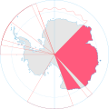
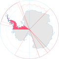
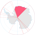
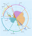
ไฟล์:Antarctica, territorial claims.svg
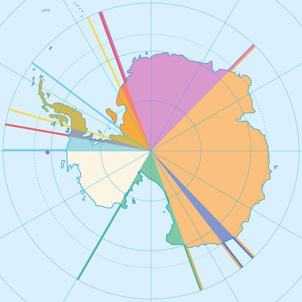
ขนาดของตัวอย่าง PNG นี้ของไฟล์ SVG นี้: 600 × 600 พิกเซล ความละเอียดอื่น: 240 × 240 พิกเซล | 480 × 480 พิกเซล | 768 × 768 พิกเซล | 1,024 × 1,024 พิกเซล | 2,048 × 2,048 พิกเซล | 820 × 820 พิกเซล
ดูภาพที่มีความละเอียดสูงกว่า ((ไฟล์ SVG, 820 × 820 พิกเซล, ขนาดไฟล์: 72 กิโลไบต์))
ประวัติไฟล์
คลิกวันที่/เวลาเพื่อดูไฟล์ที่ปรากฏในขณะนั้น
| วันที่/เวลา | รูปย่อ | ขนาด | ผู้ใช้ | ความเห็น | |
|---|---|---|---|---|---|
| ปัจจุบัน | 23:42, 8 พฤษภาคม 2563 |  | 820 × 820 (72 กิโลไบต์) | Spesh531 | Norway's claim stretches to the South Pole as of June 12 2015 |
| 11:31, 13 ตุลาคม 2552 |  | 820 × 820 (71 กิโลไบต์) | DooFi | sauerkraut | |
| 03:08, 1 กรกฎาคม 2551 |  | 806 × 806 (43 กิโลไบต์) | Lokal Profil | {{Information |Description={{en|Map showing the territorial claims to Antarctica}} {{legend|#e987eb|New Zealand}} {{legend|#fcc475|Australia}} {{legend|#8282ed|France}} {{legend|#7efa72|Norway}} {{legend|#ec787f|United Kingdom}} {{legend|#6db87f|Chile}} { |
หน้าที่มีภาพนี้
หน้าต่อไปนี้ โยงมาที่ภาพนี้:
การใช้ไฟล์ข้ามโครงการ
วิกิอื่นต่อไปนี้ใช้ไฟล์นี้:
- การใช้บน af.wikipedia.org
- การใช้บน ar.wikipedia.org
- การใช้บน ast.wikipedia.org
- การใช้บน az.wikipedia.org
- การใช้บน bn.wikipedia.org
- การใช้บน cs.wikipedia.org
- การใช้บน de.wikipedia.org
- การใช้บน en.wikipedia.org
- การใช้บน es.wikipedia.org
- การใช้บน eu.wikipedia.org
- การใช้บน fa.wikipedia.org
- การใช้บน frr.wikipedia.org
- การใช้บน fy.wikipedia.org
- การใช้บน gl.wikipedia.org
- การใช้บน hu.wikipedia.org
- การใช้บน hy.wikipedia.org
- การใช้บน id.wikipedia.org
ดูการใช้ข้ามโครงการเพิ่มเติมของไฟล์นี้

