ไฟล์:1918 map of the Caucasus by the British Army.jpg

ขนาดของตัวอย่างนี้: 492 × 599 พิกเซล ความละเอียดอื่น: 197 × 240 พิกเซล | 394 × 480 พิกเซล | 630 × 768 พิกเซล | 840 × 1,024 พิกเซล | 1,681 × 2,048 พิกเซล | 6,076 × 7,403 พิกเซล
ดูภาพที่มีความละเอียดสูงกว่า (6,076 × 7,403 พิกเซล, ขนาดไฟล์: 6.44 เมกะไบต์, ชนิดไมม์: image/jpeg)
| รูปภาพหรือไฟล์เสียงนี้ ต้นฉบับอยู่ที่ คอมมอนส์ รายละเอียดด้านล่าง เป็นข้อความที่แสดงผลจาก ไฟล์ต้นฉบับในคอมมอนส์
|
ความย่อ
| คำอธิบาย |
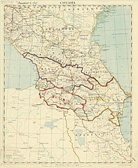
English: 1918 map of the Caucasus by the British Army, with 1919 borders drawn in. |
| วันที่ | หรือ 2461 และ 2461 หรือ 2462 |
| แหล่งที่มา | https://collections.lib.uwm.edu/digital/collection/agdm/id/1715 |
| ผู้สร้างสรรค์ | Great Britain. Army. Royal Engineers. Field Survey Co., 8th |
การอนุญาตใช้สิทธิ
This work created by the United Kingdom Government is in the public domain.
This is because it is one of the following:
HMSO has declared that the expiry of Crown Copyrights applies worldwide (ref: HMSO Email Reply)
|
 |
ประวัติไฟล์
คลิกวันที่/เวลาเพื่อดูไฟล์ที่ปรากฏในขณะนั้น
| วันที่/เวลา | รูปย่อ | ขนาด | ผู้ใช้ | ความเห็น | |
|---|---|---|---|---|---|
| ปัจจุบัน | 04:28, 9 มีนาคม 2562 | | 6,076 × 7,403 (6.44 เมกะไบต์) | Balkanique | User created page with UploadWizard |
หน้าที่มีภาพนี้
หน้าต่อไปนี้ โยงมาที่ภาพนี้:
การใช้ไฟล์ข้ามโครงการ
วิกิอื่นต่อไปนี้ใช้ไฟล์นี้:
- การใช้บน az.wikipedia.org
- การใช้บน cs.wikipedia.org
- การใช้บน en.wikipedia.org
- การใช้บน es.wikipedia.org
- การใช้บน fr.wikipedia.org
- การใช้บน hy.wikipedia.org
- การใช้บน it.wikipedia.org
- การใช้บน ka.wikipedia.org
- การใช้บน mt.wikipedia.org
- การใช้บน nl.wikipedia.org
- การใช้บน pl.wikipedia.org
- การใช้บน ru.wikipedia.org
- การใช้บน tr.wikipedia.org
- การใช้บน www.wikidata.org
- การใช้บน zh.wikipedia.org