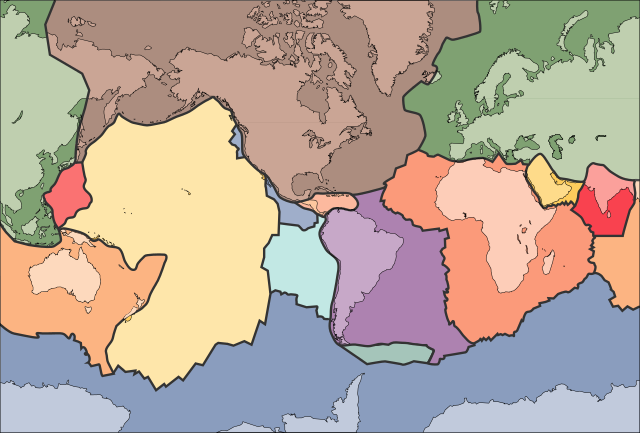
ไฟล์:Tectonic plates (empty).svg

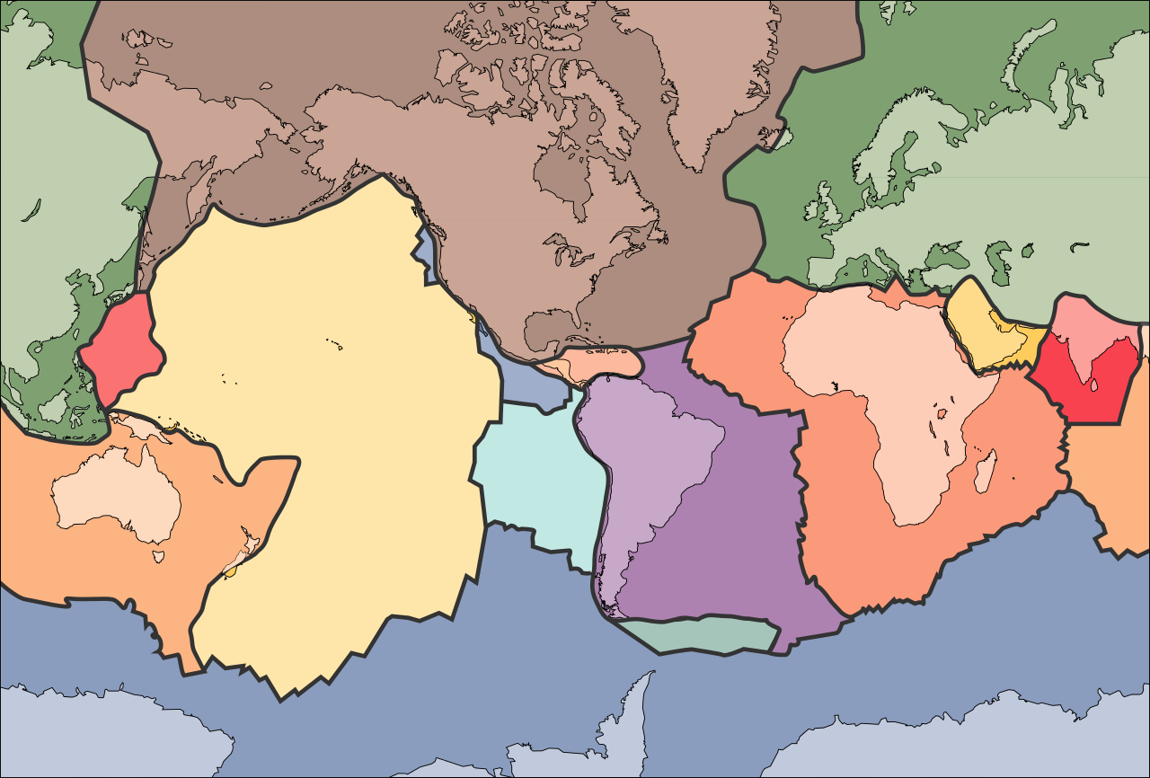
ขนาดของตัวอย่าง PNG นี้ของไฟล์ SVG นี้: 681 × 461 พิกเซล ความละเอียดอื่น: 320 × 217 พิกเซล | 640 × 433 พิกเซล | 1,024 × 693 พิกเซล | 1,280 × 866 พิกเซล | 2,560 × 1,733 พิกเซล
ดูภาพที่มีความละเอียดสูงกว่า ((ไฟล์ SVG, 681 × 461 พิกเซล, ขนาดไฟล์: 356 กิโลไบต์))
| รูปภาพหรือไฟล์เสียงนี้ ต้นฉบับอยู่ที่ คอมมอนส์ รายละเอียดด้านล่าง เป็นข้อความที่แสดงผลจาก ไฟล์ต้นฉบับในคอมมอนส์
|
الخلافه الرشيديهkp
ความย่อ
| คำอธิบาย | |
| วันที่ | 10 กันยายน พ.ศ. 2548 (upload date) |
| แหล่งที่มา | File:Tectonic plates (empty).png |
| ผู้สร้างสรรค์ | Ævar Arnfjörð Bjarmason |
| เวอร์ชันอื่น |
This file was derived from: Tectonic plates (empty).png:
[]
|
| SVG genesis | ไฟล์ภาพกราฟิกส์เวกเตอร์ W3C ตรวจสอบแล้วมีข้อผิดพลาดในไฟล์นี้ สร้างขึ้นโดยใช้ Adobe Illustrator, และโดย Inkscape. |


.png)


.svg)
.png)
การอนุญาตใช้สิทธิ
This image is in the public domain in the United States because it only contains materials that originally came from the United States Geological Survey, an agency of the United States Department of the Interior. For more information, see the official USGS copyright policy.
|
ประวัติไฟล์
คลิกวันที่/เวลาเพื่อดูไฟล์ที่ปรากฏในขณะนั้น
| วันที่/เวลา | รูปย่อ | ขนาด | ผู้ใช้ | ความเห็น | |
|---|---|---|---|---|---|
| ปัจจุบัน | 09:04, 11 ตุลาคม 2549 | | 681 × 461 (356 กิโลไบต์) | Sting | Borders correction integrated to the continents borders; size of picture |
| 23:29, 10 ตุลาคม 2549 |  | 682 × 462 (285 กิโลไบต์) | Rogilbert~commonswiki | correction de frontières 2 | |
| 23:14, 10 ตุลาคม 2549 |  | 682 × 462 (212 กิโลไบต์) | Rogilbert~commonswiki | correction des frontière | |
| 20:48, 10 กันยายน 2548 |  | 682 × 462 (199 กิโลไบต์) | Ævar Arnfjörð Bjarmason | SVG version of Image:Tectonic plates (empty).png {{PD-USGov-USGS}} Category:Plate tectonics |
.png)
หน้าที่มีภาพนี้
หน้าต่อไปนี้ โยงมาที่ภาพนี้:
การใช้ไฟล์ข้ามโครงการ
วิกิอื่นต่อไปนี้ใช้ไฟล์นี้:
- การใช้บน ar.wikipedia.org
- การใช้บน az.wikipedia.org
- การใช้บน bn.wikipedia.org
- การใช้บน en.wikipedia.org
- Earth
- Internal structure of Earth
- Wikipedia:Graphics Lab/Image workshop/Archive/Jan 2009
- User:AvionArchon/sandbox
- User:Darth Tacker/TWA/Earth
- User:CheChe/Spoken Script
- User:Zanygenius/TWA/Earth
- User:Zanygenius/TWA/Earth/2
- User:Google7722/TWA/Earth
- Portal:Geophysics
- Portal:World
- User:FreshYoMama/TWA/Earth
- User:FreshYoMama/TWA/Earth/2
- การใช้บน en.wikiversity.org
- การใช้บน eo.wikipedia.org
- Kontinento
- Platotektoniko
- Litosfero
- Tektona plato
- Ŝablono:Tektonaj platoj
- Antarkta plato
- Eŭrazia plato
- Nordamerika plato
- Sudamerika plato
- Afrika plato
- Pacifika plato
- Hindia plato
- Aŭstralia plato
- Plato Nazca
- Anatolia plato
- Arabia plato
- Filipina plato
- Kokosa plato
- Karibia plato
- Plato Juan de Fuca
- Hind-Aŭstralia Plato
- การใช้บน es.wikipedia.org
- การใช้บน fa.wikipedia.org
- การใช้บน fr.wikipedia.org
- การใช้บน gl.wikipedia.org
- การใช้บน hu.wikipedia.org
- การใช้บน id.wikipedia.org
- การใช้บน io.wikipedia.org
ดูการใช้ข้ามโครงการเพิ่มเติมของไฟล์นี้
.svg)
.svg)