ไฟล์:Slovakia - background map.png

ขนาดของตัวอย่างนี้: 800 × 431 พิกเซล ความละเอียดอื่น: 320 × 172 พิกเซล | 640 × 345 พิกเซล | 1,170 × 630 พิกเซล
ดูภาพที่มีความละเอียดสูงกว่า (1,170 × 630 พิกเซล, ขนาดไฟล์: 1.32 เมกะไบต์, ชนิดไมม์: image/png)
| รูปภาพหรือไฟล์เสียงนี้ ต้นฉบับอยู่ที่ คอมมอนส์ รายละเอียดด้านล่าง เป็นข้อความที่แสดงผลจาก ไฟล์ต้นฉบับในคอมมอนส์
|
ความย่อ
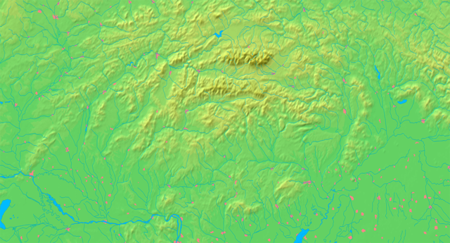
| คำอธิบาย | Background map of Slovakia, ready for the Geobox template, calibrated at en:Template:Geobox locator Slovakia | ||||
| วันที่ | |||||
| แหล่งที่มา | Made my myself from free maps available at www.demis.nl | ||||
| ผู้สร้างสรรค์ | Caroig | ||||
| การอนุญาต (การใช้ไฟล์นี้ใหม่) |
|
||||
| เวอร์ชันอื่น | ไฟล์อื่นที่ใช้ไฟล์นี้: Slovakia - physical map.png |
ประวัติไฟล์
คลิกวันที่/เวลาเพื่อดูไฟล์ที่ปรากฏในขณะนั้น
| วันที่/เวลา | รูปย่อ | ขนาด | ผู้ใช้ | ความเห็น | |
|---|---|---|---|---|---|
| ปัจจุบัน | 02:07, 9 กันยายน 2550 | | 1,170 × 630 (1.32 เมกะไบต์) | Caroig | better version |
| 01:10, 9 กันยายน 2550 |  | 1,170 × 630 (1.31 เมกะไบต์) | Caroig | ||
| 00:04, 4 กันยายน 2550 |  | 2,340 × 1,259 (1.61 เมกะไบต์) | Caroig | == Summary == {{Information |Description=Background map of Slovakia, for Geoboxes, the same boundaries as Image:Slovakia - outline map.svg |Source=Made my myself from free maps available at www.demis.nl |Date=2007-09-03 |Autho |
หน้าที่มีภาพนี้
หน้าต่อไปนี้ โยงมาที่ภาพนี้:
การใช้ไฟล์ข้ามโครงการ
วิกิอื่นต่อไปนี้ใช้ไฟล์นี้:
- การใช้บน ar.wikipedia.org
- การใช้บน arz.wikipedia.org
- การใช้บน en.wikipedia.org
- การใช้บน eo.wikipedia.org
- Distrikto Komárno
- Distrikto Zvolen
- Hron
- Granda Fatro
- Nacia parko Poloniny
- Sajó
- Distrikto Detva
- Distrikto Krupina
- Distrikto Banská Štiavnica
- Distrikto Žarnovica
- Distrikto Žiar nad Hronom
- Distrikto Banská Bystrica
- Distrikto Veľký Krtíš
- Distrikto Poltár
- Distrikto Lučenec
- Distrikto Brezno
- Distrikto Rimavská Sobota
- Distrikto Revúca
- Distrikto Rožňava
- Distrikto Levice
- Distrikto Snina
- Distrikto Svidník
- Distrikto Prešov
- Distrikto Humenné
- Distrikto Medzilaborce
- Distrikto Stropkov
- Distrikto Stará Ľubovňa
- Váh
- Distrikto Bardejov
- Distrikto Sabinov
- Distrikto Bytča
- Distrikto Bánovce nad Bebravou
- Distrikto Dolný Kubín
- Distrikto Dunajská Streda
- Distrikto Galanta
- Distrikto Gelnica
- Distrikto Hlohovec
- Distrikto Ilava
- Distrikto Kežmarok
- Distrikto Košice-ĉirkaŭaĵo
- Distrikto Kysucké Nové Mesto
ดูการใช้ข้ามโครงการเพิ่มเติมของไฟล์นี้