ไฟล์:Ocean gravity map.gif
ขนาดของตัวอย่างนี้: 800 × 473 พิกเซล ความละเอียดอื่น: 320 × 189 พิกเซล | 640 × 378 พิกเซล | 1,010 × 597 พิกเซล
ดูภาพที่มีความละเอียดสูงกว่า (1,010 × 597 พิกเซล, ขนาดไฟล์: 466 กิโลไบต์, ชนิดไมม์: image/gif)
| รูปภาพหรือไฟล์เสียงนี้ ต้นฉบับอยู่ที่ คอมมอนส์ รายละเอียดด้านล่าง เป็นข้อความที่แสดงผลจาก ไฟล์ต้นฉบับในคอมมอนส์
|
| คำอธิบาย |
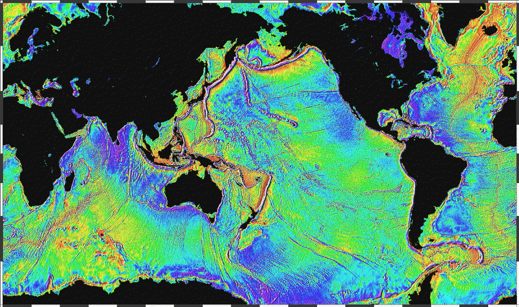
English: Ocean basins mapped with satellite altimetry. Seafloor features larger than 10 km are detected by resulting gravitational distortion of sea surface. |
| วันที่ | |
| แหล่งที่มา | http://www.ngdc.noaa.gov/mgg/bathymetry/predicted/explore.HTML |
| ผู้สร้างสรรค์ | NOAA |
This image is in the public domain because it contains materials that originally came from the U.S. National Oceanic and Atmospheric Administration, taken or made as part of an employee's official duties.
|
ประวัติไฟล์
คลิกวันที่/เวลาเพื่อดูไฟล์ที่ปรากฏในขณะนั้น
| วันที่/เวลา | รูปย่อ | ขนาด | ผู้ใช้ | ความเห็น | |
|---|---|---|---|---|---|
| ปัจจุบัน | 05:18, 4 เมษายน 2549 | | 1,010 × 597 (466 กิโลไบต์) | Korrigan | Ocean basins mapped with satellite altimetry. Seafloor features larger than 10 km are detected by resulting gravitational distortion of sea surface. Source: http://www.ngdc.noaa.gov/mgg/bathymetry/predicted/explore.HTML {{PD-USGov-DOC-NOAA}} [[Cate |
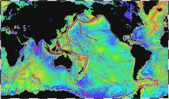
| 03:36, 20 มีนาคม 2549 |  | 1,010 × 597 (196 กิโลไบต์) | Maksim | La bildo estas kopiita de wikipedia:en. La originala priskribo estas: Ocean basins mapped with satellite altimetry. Seafloor features larger than 10 km are detected by resulting gravitational distortion of sea surface. Source: http://www.ngdc.noaa.go |
หน้าที่มีภาพนี้
หน้าต่อไปนี้ โยงมาที่ภาพนี้:
การใช้ไฟล์ข้ามโครงการ
วิกิอื่นต่อไปนี้ใช้ไฟล์นี้:
- การใช้บน bs.wikipedia.org
- การใช้บน bxr.wikipedia.org
- การใช้บน cs.wikipedia.org
- การใช้บน de.wikipedia.org
- การใช้บน el.wikipedia.org
- การใช้บน en.wikipedia.org
- การใช้บน eo.wikipedia.org
- การใช้บน es.wikipedia.org
- การใช้บน et.wikipedia.org
- การใช้บน fi.wikipedia.org
- การใช้บน fo.wikipedia.org
- การใช้บน fr.wikipedia.org
- การใช้บน fr.wiktionary.org
- การใช้บน gd.wikipedia.org
- การใช้บน gl.wikipedia.org
- การใช้บน gu.wikipedia.org
- การใช้บน he.wikipedia.org
- การใช้บน hi.wikipedia.org
- การใช้บน hr.wikipedia.org
- การใช้บน ht.wikipedia.org
- การใช้บน hy.wikipedia.org
- การใช้บน hyw.wikipedia.org
- การใช้บน ja.wikipedia.org
- การใช้บน kk.wikipedia.org
- การใช้บน la.wikipedia.org
- การใช้บน lv.wikipedia.org
- การใช้บน mn.wikipedia.org
- การใช้บน ru.wikipedia.org
- การใช้บน scn.wikipedia.org
- การใช้บน sh.wikipedia.org
- การใช้บน sl.wikipedia.org
- การใช้บน sv.wikipedia.org
- การใช้บน ta.wikipedia.org
ดูการใช้ข้ามโครงการเพิ่มเติมของไฟล์นี้