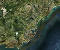
ไฟล์:Monaco satellite map.png

ขนาดของตัวอย่างนี้: 715 × 599 พิกเซล ความละเอียดอื่น: 286 × 240 พิกเซล | 573 × 480 พิกเซล | 798 × 669 พิกเซล
ดูภาพที่มีความละเอียดสูงกว่า (798 × 669 พิกเซล, ขนาดไฟล์: 1.07 เมกะไบต์, ชนิดไมม์: image/png)
ประวัติไฟล์
คลิกวันที่/เวลาเพื่อดูไฟล์ที่ปรากฏในขณะนั้น
| วันที่/เวลา | รูปย่อ | ขนาด | ผู้ใช้ | ความเห็น | |
|---|---|---|---|---|---|
| ปัจจุบัน | 15:52, 9 มิถุนายน 2556 |  | 798 × 669 (1.07 เมกะไบต์) | Soerfm | Crop |
| 05:37, 7 มีนาคม 2554 |  | 924 × 772 (1.49 เมกะไบต์) | Swfarnsworth | Yellow line is now accurate, whereas it made the country look disproportionally large beforehand. | |
| 11:14, 21 มีนาคม 2549 |  | 992 × 653 (847 กิโลไบต์) | Roke~commonswiki | Satellite map of Monaco {{PD-WorldWind}} Category: Monaco |
หน้าที่มีภาพนี้
หน้าต่อไปนี้ โยงมาที่ภาพนี้:
การใช้ไฟล์ข้ามโครงการ
วิกิอื่นต่อไปนี้ใช้ไฟล์นี้:
- การใช้บน af.wikipedia.org
- การใช้บน ar.wikipedia.org
- การใช้บน azb.wikipedia.org
- การใช้บน bcl.wikipedia.org
- การใช้บน bg.wikipedia.org
- การใช้บน ca.wikipedia.org
- การใช้บน en.wikipedia.org
- การใช้บน en.wiktionary.org
- การใช้บน he.wikipedia.org
- การใช้บน hyw.wikipedia.org
- การใช้บน id.wikipedia.org
- การใช้บน is.wikipedia.org
- การใช้บน ja.wikipedia.org
- การใช้บน ka.wikipedia.org
- การใช้บน lt.wikipedia.org
- การใช้บน mk.wikipedia.org
- การใช้บน nn.wikipedia.org
- การใช้บน pl.wikipedia.org
- การใช้บน pl.wiktionary.org
- การใช้บน ps.wikipedia.org
- การใช้บน ro.wikipedia.org
- การใช้บน sg.wiktionary.org
- การใช้บน sl.wikipedia.org
- การใช้บน sv.wikipedia.org
- การใช้บน szl.wikipedia.org
- การใช้บน te.wikipedia.org
- การใช้บน uk.wikipedia.org
- การใช้บน vep.wikipedia.org
- การใช้บน zh.wikipedia.org
