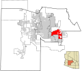
ไฟล์:Maricopa County Incorporated and Planning areas Mesa highlighted.svg

ขนาดของตัวอย่าง PNG นี้ของไฟล์ SVG นี้: 694 × 599 พิกเซล ความละเอียดอื่น: 278 × 240 พิกเซล | 556 × 480 พิกเซล | 889 × 768 พิกเซล | 1,185 × 1,024 พิกเซล | 2,371 × 2,048 พิกเซล | 940 × 812 พิกเซล
ดูภาพที่มีความละเอียดสูงกว่า ((ไฟล์ SVG, 940 × 812 พิกเซล, ขนาดไฟล์: 1.05 เมกะไบต์))
ประวัติไฟล์
คลิกวันที่/เวลาเพื่อดูไฟล์ที่ปรากฏในขณะนั้น
| วันที่/เวลา | รูปย่อ | ขนาด | ผู้ใช้ | ความเห็น | |
|---|---|---|---|---|---|
| ปัจจุบัน | 13:36, 20 พฤษภาคม 2554 |  | 940 × 812 (1.05 เมกะไบต์) | Ixnayonthetimmay | Uploading new version |
| 11:22, 30 สิงหาคม 2551 |  | 900 × 800 (413 กิโลไบต์) | Ixnayonthetimmay | == Summary == {{Information |Description=This map shows the incorporated areas and unincorporated areas in Maricopa County, Arizona. [[:en:Mesa, Arizona|Mesa | |
| 06:58, 16 กันยายน 2550 |  | 900 × 800 (384 กิโลไบต์) | Ixnayonthetimmay | ||
| 17:09, 28 พฤษภาคม 2550 |  | 900 × 780 (329 กิโลไบต์) | Ixnayonthetimmay | ||
| 07:13, 22 พฤษภาคม 2550 |  | 900 × 780 (318 กิโลไบต์) | Ixnayonthetimmay | ||
| 12:17, 30 มกราคม 2550 |  | 904 × 758 (177 กิโลไบต์) | Ixnayonthetimmay | {{Information |Description=This map shows the incorporated areas in Maricopa County, Arizona, highlighting Mesa in red. It also shows the boundaries for the municip |
หน้าที่มีภาพนี้
หน้าต่อไปนี้ โยงมาที่ภาพนี้:
การใช้ไฟล์ข้ามโครงการ
วิกิอื่นต่อไปนี้ใช้ไฟล์นี้:
- การใช้บน bn.wikipedia.org
- การใช้บน br.wikipedia.org
- การใช้บน ceb.wikipedia.org
- การใช้บน cs.wikipedia.org
- การใช้บน de.wikipedia.org
- การใช้บน et.wikipedia.org
- การใช้บน fa.wikipedia.org
- การใช้บน fi.wikipedia.org
- การใช้บน he.wikipedia.org
- การใช้บน hu.wikipedia.org
- การใช้บน ja.wikipedia.org
- การใช้บน ko.wikipedia.org
- การใช้บน kw.wikipedia.org
- การใช้บน pam.wikipedia.org
- การใช้บน pt.wikipedia.org
- การใช้บน ro.wikipedia.org
- การใช้บน sk.wikipedia.org
- การใช้บน sl.wikipedia.org
- การใช้บน sv.wikipedia.org
- การใช้บน sw.wikipedia.org
- การใช้บน tr.wikipedia.org
- การใช้บน ur.wikipedia.org
- การใช้บน vi.wikipedia.org
- การใช้บน zh.wikipedia.org