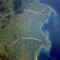
ไฟล์:Godavari satellite view.jpg

ขนาดของตัวอย่างนี้: 600 × 600 พิกเซล ความละเอียดอื่น: 240 × 240 พิกเซล | 480 × 480 พิกเซล | 768 × 768 พิกเซล | 1,024 × 1,024 พิกเซล | 2,048 × 2,048 พิกเซล | 5,248 × 5,248 พิกเซล
ดูภาพที่มีความละเอียดสูงกว่า (5,248 × 5,248 พิกเซล, ขนาดไฟล์: 8.05 เมกะไบต์, ชนิดไมม์: image/jpeg)
ประวัติไฟล์
คลิกวันที่/เวลาเพื่อดูไฟล์ที่ปรากฏในขณะนั้น
| วันที่/เวลา | รูปย่อ | ขนาด | ผู้ใช้ | ความเห็น | |
|---|---|---|---|---|---|
| ปัจจุบัน | 02:27, 5 มีนาคม 2561 |  | 5,248 × 5,248 (8.05 เมกะไบต์) | Ras67 | levels adjusted |
| 02:24, 5 มีนาคม 2561 |  | 5,248 × 5,248 (8.28 เมกะไบต์) | Ras67 | high resolution | |
| 06:11, 22 ตุลาคม 2551 |  | 640 × 640 (128 กิโลไบต์) | File Upload Bot (Magnus Manske) | {{BotMoveToCommons|fr.wikipedia}} {{Information |Description={{fr|les deltas de la Godâvarî et de la Krishnâ STS034-077-029 Godavari and Krishna River Deltas, India October 1989 The mouths of the Godavari River (east) and the Krishna River (wes |
หน้าที่มีภาพนี้
ไม่มีหน้าใดโยงมาที่ภาพนี้
การใช้ไฟล์ข้ามโครงการ
วิกิอื่นต่อไปนี้ใช้ไฟล์นี้:
- การใช้บน af.wikipedia.org
- การใช้บน ar.wikipedia.org
- การใช้บน arz.wikipedia.org
- การใช้บน ast.wikipedia.org
- การใช้บน az.wikipedia.org
- การใช้บน bh.wikipedia.org
- การใช้บน br.wikipedia.org
- การใช้บน ca.wikipedia.org
- การใช้บน ce.wikipedia.org
- การใช้บน cy.wikipedia.org
- การใช้บน de.wikivoyage.org
- การใช้บน el.wikipedia.org
- การใช้บน en.wikipedia.org
- การใช้บน en.wiktionary.org
- การใช้บน eo.wikipedia.org
- การใช้บน es.wikipedia.org
- การใช้บน eu.wikipedia.org
- การใช้บน fi.wikipedia.org
- การใช้บน fr.wikivoyage.org
- การใช้บน ga.wikipedia.org
- การใช้บน gl.wikipedia.org
- การใช้บน ha.wikipedia.org
- การใช้บน he.wikipedia.org
- การใช้บน hy.wikipedia.org
- การใช้บน id.wikipedia.org
- การใช้บน it.wikipedia.org
- การใช้บน ka.wikipedia.org
- การใช้บน mr.wikipedia.org
- การใช้บน ne.wikipedia.org
- การใช้บน new.wikipedia.org
- การใช้บน nn.wikipedia.org
- การใช้บน no.wikipedia.org
- การใช้บน os.wikipedia.org
- การใช้บน pa.wikipedia.org
- การใช้บน pl.wikipedia.org
- การใช้บน pnb.wikipedia.org
- การใช้บน ps.wikipedia.org
- การใช้บน pt.wikipedia.org
- การใช้บน ru.wikipedia.org
- การใช้บน sa.wikipedia.org
ดูการใช้ข้ามโครงการเพิ่มเติมของไฟล์นี้

