ไฟล์:German counter in Alsace Lorraine.jpg
ขนาดของตัวอย่างนี้: 786 × 600 พิกเซล ความละเอียดอื่น: 315 × 240 พิกเซล | 629 × 480 พิกเซล | 1,007 × 768 พิกเซล | 1,265 × 965 พิกเซล
ดูภาพที่มีความละเอียดสูงกว่า (1,265 × 965 พิกเซล, ขนาดไฟล์: 2.1 เมกะไบต์, ชนิดไมม์: image/jpeg)
| รูปภาพหรือไฟล์เสียงนี้ ต้นฉบับอยู่ที่ คอมมอนส์ รายละเอียดด้านล่าง เป็นข้อความที่แสดงผลจาก ไฟล์ต้นฉบับในคอมมอนส์
|

|
This file has been superseded by German counter in Alsace Lorraine.svg. It is recommended to use the other file. Please note that deleting superseded images requires consent.
|

|
ความย่อ
| คำอธิบาย |
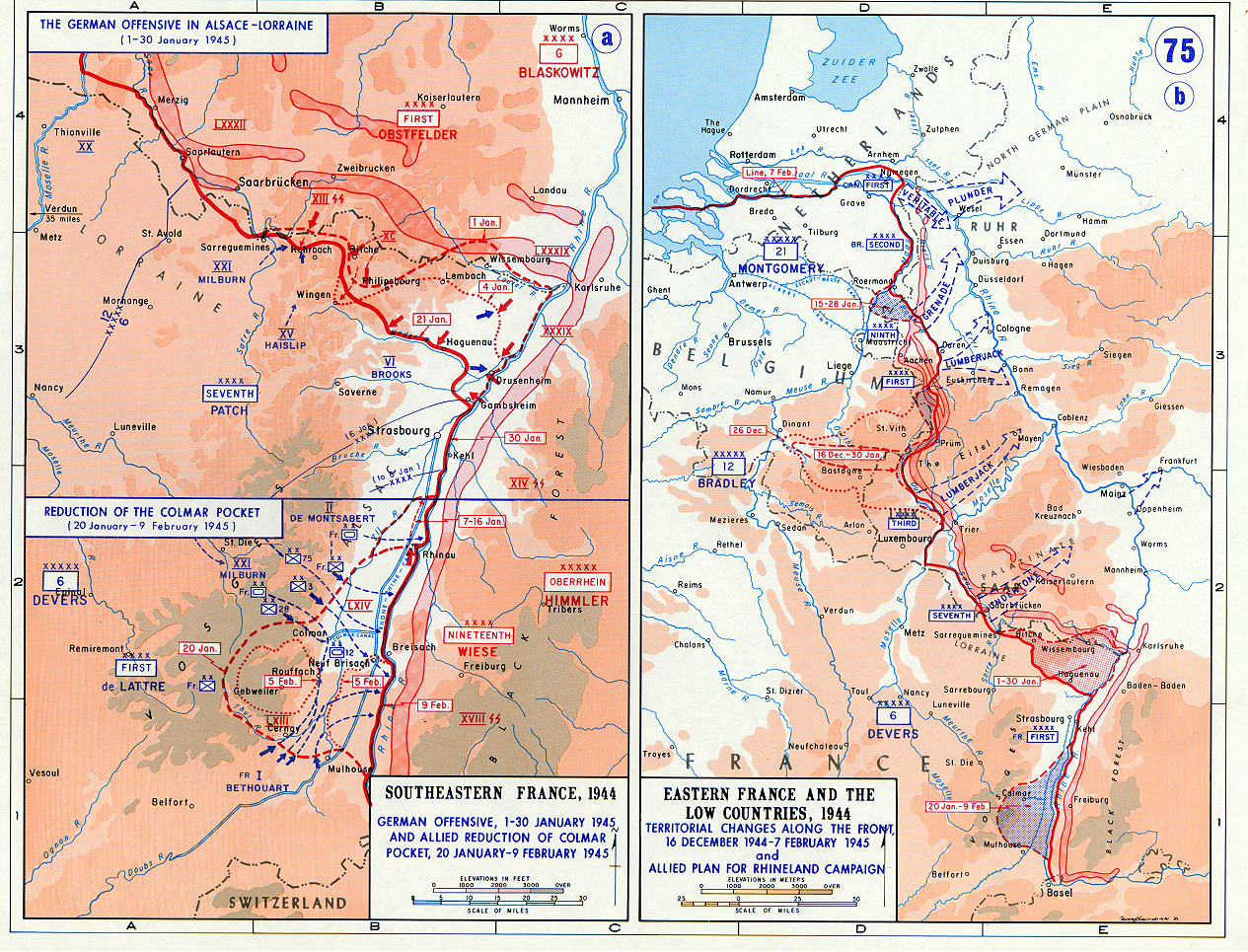
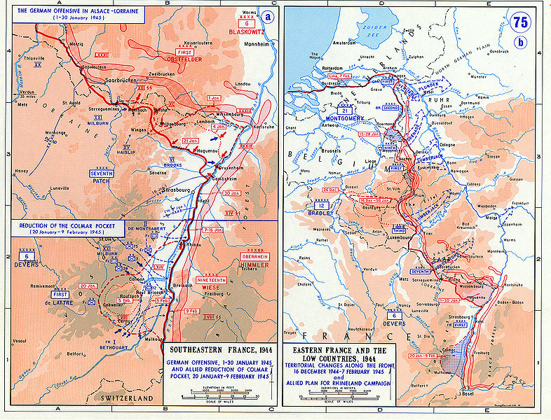
English: Operations map of German counter in Alsace Lorraine in January 1945 . It is erronously titled "Southeastern France", when it actually shows the northeastern part of France. |
| วันที่ | ไม่ทราบวัน |
| แหล่งที่มา | http://www.jewishvirtuallibrary.org/jsource/ww2/Germancounter3.html |
| ผู้สร้างสรรค์ | US Army Military History Institute |
| เวอร์ชันอื่น | ไฟล์อื่นที่ใช้ไฟล์นี้: German counter in northern Alsace Lorraine.jpg |
การอนุญาตใช้สิทธิ
This file is a work of a U.S. Army soldier or employee, taken or made as part of that person's official duties. As a work of the U.S. federal government, it is in the public domain in the United States.
|
 |
ประวัติไฟล์
คลิกวันที่/เวลาเพื่อดูไฟล์ที่ปรากฏในขณะนั้น
| วันที่/เวลา | รูปย่อ | ขนาด | ผู้ใช้ | ความเห็น | |
|---|---|---|---|---|---|
| ปัจจุบัน | 01:04, 20 กรกฎาคม 2552 | | 1,265 × 965 (2.1 เมกะไบต์) | TCY | {{Information |Description={{en|1=Operations map of German counter in Alsace Lorraine in January 1945}} |Source= http://www.jewishvirtuallibrary.org/jsource/ww2/Germancounter3.html |Author=US Army Military History Institute |Da |
หน้าที่มีภาพนี้
หน้าต่อไปนี้ โยงมาที่ภาพนี้:
การใช้ไฟล์ข้ามโครงการ
วิกิอื่นต่อไปนี้ใช้ไฟล์นี้:
- การใช้บน ar.wikipedia.org
- การใช้บน bg.wikipedia.org
- การใช้บน de.wikipedia.org
- การใช้บน es.wikipedia.org
- การใช้บน fa.wikipedia.org
- การใช้บน fr.wikipedia.org
- การใช้บน he.wikipedia.org
- การใช้บน id.wikipedia.org
- การใช้บน ja.wikipedia.org
- การใช้บน ko.wikipedia.org
- การใช้บน nl.wikipedia.org
- การใช้บน pl.wikipedia.org
- การใช้บน pt.wikipedia.org
- การใช้บน ro.wikipedia.org
- การใช้บน ru.wikipedia.org
- การใช้บน sv.wikipedia.org
- การใช้บน ta.wikipedia.org
- การใช้บน uk.wikipedia.org
- การใช้บน www.wikidata.org