ไฟล์:Alberta County Point Locator.svg

ขนาดของตัวอย่าง PNG นี้ของไฟล์ SVG นี้: 369 × 599 พิกเซล ความละเอียดอื่น: 148 × 240 พิกเซล | 295 × 480 พิกเซล | 473 × 768 พิกเซล | 630 × 1,024 พิกเซล | 1,261 × 2,048 พิกเซล | 945 × 1,535 พิกเซล
ดูภาพที่มีความละเอียดสูงกว่า ((ไฟล์ SVG, 945 × 1,535 พิกเซล, ขนาดไฟล์: 632 กิโลไบต์))
| รูปภาพหรือไฟล์เสียงนี้ ต้นฉบับอยู่ที่ คอมมอนส์ รายละเอียดด้านล่าง เป็นข้อความที่แสดงผลจาก ไฟล์ต้นฉบับในคอมมอนส์
|
She was
ความย่อ
| คำอธิบาย |
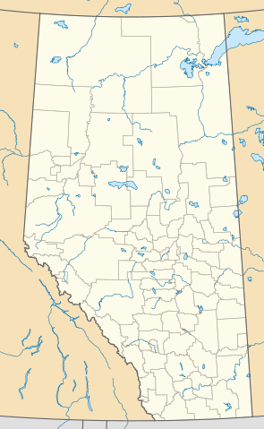
English: This map is made to the same dimensions as most provincial government products, and is intended to replace earlier Alberta locators because
Projection: EPSG:3401, transverse mercator, central meridian 115W Extents: -400000 W, 400000 E, 5400000 S, 6700000 N Feel free to make or request cosmetic modifications. |
| วันที่ | |
| แหล่งที่มา | งานของตัว |
| ผู้สร้างสรรค์ | awmcphee |
การอนุญาตใช้สิทธิ
ข้าพเจ้า ในฐานะผู้ถือลิขสิทธิ์ของภาพหรือสื่อนี้ อนุญาตให้ใช้ภาพหรือสื่อนี้ภายใต้เงื่อนไขต่อไปนี้
| ไฟล์นี้มีให้ใช้ภายใต้ CC0 1.0 Universal Public Domain Dedication ของครีเอทีฟคอมมอนส์ | |
| The person who associated a work with this deed has dedicated the work to the public domain by waiving all of their rights to the work worldwide under copyright law, including all related and neighboring rights, to the extent allowed by law. You can copy, modify, distribute and perform the work, even for commercial purposes, all without asking permission.
|
ประวัติไฟล์
คลิกวันที่/เวลาเพื่อดูไฟล์ที่ปรากฏในขณะนั้น
| วันที่/เวลา | รูปย่อ | ขนาด | ผู้ใช้ | ความเห็น | |
|---|---|---|---|---|---|
| ปัจจุบัน | 05:10, 14 สิงหาคม 2563 | | 945 × 1,535 (632 กิโลไบต์) | Awmcphee | Reduced opacity of county boundaries - for legibility. |
| 00:52, 7 มิถุนายน 2562 |  | 945 × 1,535 (613 กิโลไบต์) | Awmcphee | User created page with UploadWizard |
หน้าที่มีภาพนี้
หน้าต่อไปนี้ โยงมาที่ภาพนี้:
การใช้ไฟล์ข้ามโครงการ
วิกิอื่นต่อไปนี้ใช้ไฟล์นี้:
- การใช้บน bn.wikipedia.org
- การใช้บน ca.wikipedia.org
- Reserva índia Alexis 133
- Reserva índia Alexis Cardinal River 234
- Reserva índia Alexis Elk River 233
- Reserva índia Alexis Whitecourt 232
- Reserva índia Buck Lake 133C
- Reserva índia Wabamun 133A
- Reserva índia Wabamun 133B
- Reserva índia Eden Valley 216
- Reserva índia Big Horn 144a
- Reserves índies Stoney 142, 143, i 144
- Mòdul:Location map/data/Alberta
- Mòdul:Location map/data/Canadà Alberta
- Mòdul:Location map/data/Canadà Alberta/ús
- การใช้บน de.wikipedia.org
- การใช้บน en.wikipedia.org
- Vulcan, Alberta
- Red Deer, Alberta
- Grand Centre, Alberta
- Lake Louise, Alberta
- Camrose, Alberta
- Wainwright, Alberta
- Medicine Hat
- Head-Smashed-In Buffalo Jump
- Lethbridge
- Edmonton International Airport
- St. Albert, Alberta
- Fort McMurray
- Grande Prairie
- Bragg Creek
- Spruce Grove
- Leduc, Alberta
- Banff, Alberta
- Turner Valley
- Sylvan Lake, Alberta
- Black Diamond, Alberta
- Fort Chipewyan
- Hinton, Alberta
- Elk Point, Alberta
- Pincher Creek
- Vegreville
- Magrath, Alberta
- Bassano, Alberta
- Willmore Wilderness Park
- Wetaskiwin
- Fort Saskatchewan
- Chateau Lake Louise
ดูการใช้ข้ามโครงการเพิ่มเติมของไฟล์นี้