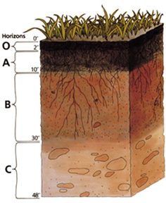
ไฟล์:Soil profile.jpg
Soil_profile.jpg (236 × 288 พิกเซล, ขนาดไฟล์: 39 กิโลไบต์, ชนิดไมม์: image/jpeg)
ประวัติไฟล์
คลิกวันที่/เวลาเพื่อดูไฟล์ที่ปรากฏในขณะนั้น
| วันที่/เวลา | รูปย่อ | ขนาด | ผู้ใช้ | ความเห็น | |
|---|---|---|---|---|---|
| ปัจจุบัน | 07:35, 24 พฤศจิกายน 2547 |  | 236 × 288 (39 กิโลไบต์) | Paleorthid | Soil profile 236x288 38.76 KB {{PD-USGov-USDA}} |
หน้าที่มีภาพนี้
หน้าต่อไปนี้ โยงมาที่ภาพนี้:
การใช้ไฟล์ข้ามโครงการ
วิกิอื่นต่อไปนี้ใช้ไฟล์นี้:
- การใช้บน af.wikipedia.org
- การใช้บน ar.wikipedia.org
- การใช้บน ast.wikipedia.org
- การใช้บน as.wikipedia.org
- การใช้บน az.wikipedia.org
- การใช้บน be-tarask.wikipedia.org
- การใช้บน be.wikipedia.org
- การใช้บน bh.wikipedia.org
- การใช้บน bjn.wikipedia.org
- การใช้บน bn.wikipedia.org
- การใช้บน ca.wikipedia.org
- การใช้บน cs.wikipedia.org
- การใช้บน cy.wikipedia.org
- การใช้บน da.wikipedia.org
- การใช้บน de.wikipedia.org
- Podsol
- Boden (Bodenkunde)
- Solonetz
- USDA Soil Taxonomy
- Inceptisol
- Entisol
- Andisol
- Gelisol
- Alfisol
- Oxisol
- Histosol
- Spodosol
- Ultisol
- Aridisol
- Vertisol
- Mollisol
- Portal:Geowissenschaften
- Portal:Geowissenschaften/Disziplinen
- Benutzer:BK-Thorsten/Entwurf
- Benutzer:BK-Thorsten
- Acrisol
- Ferralsol
- Nitisol
- Cryosol
- Benutzer:Flaovia/Humus
ดูการใช้ข้ามโครงการเพิ่มเติมของไฟล์นี้


