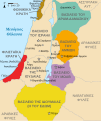
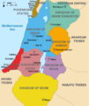
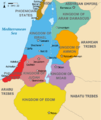
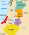
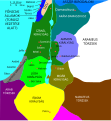
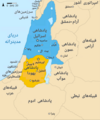
ไฟล์:Kingdoms of Israel and Judah map 830.svg

ขนาดของตัวอย่าง PNG นี้ของไฟล์ SVG นี้: 502 × 599 พิกเซล ความละเอียดอื่น: 201 × 240 พิกเซล | 402 × 480 พิกเซล | 644 × 768 พิกเซล | 858 × 1,024 พิกเซล | 1,717 × 2,048 พิกเซล | 720 × 859 พิกเซล
ดูภาพที่มีความละเอียดสูงกว่า ((ไฟล์ SVG, 720 × 859 พิกเซล, ขนาดไฟล์: 96 กิโลไบต์))
ประวัติไฟล์
คลิกวันที่/เวลาเพื่อดูไฟล์ที่ปรากฏในขณะนั้น
| วันที่/เวลา | รูปย่อ | ขนาด | ผู้ใช้ | ความเห็น | |
|---|---|---|---|---|---|
| ปัจจุบัน | 21:12, 1 ตุลาคม 2564 |  | 720 × 859 (96 กิโลไบต์) | Sadopaul | File uploaded using svgtranslate tool (https://svgtranslate.toolforge.org/). Added translation for ko. |
| 22:50, 10 กุมภาพันธ์ 2560 |  | 720 × 859 (80 กิโลไบต์) | Malus Catulus | removed 'Sizu' - a weird artifact from the Norse original | |
| 06:48, 13 กุมภาพันธ์ 2554 |  | 720 × 859 (78 กิโลไบต์) | Malus Catulus | - | |
| 18:29, 13 กรกฎาคม 2553 | 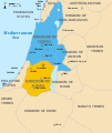 | 720 × 859 (79 กิโลไบต์) | Malus Catulus | Fixed Judah color | |
| 17:51, 13 กรกฎาคม 2553 |  | 720 × 859 (79 กิโลไบต์) | Malus Catulus | Added colors for the two kingdoms and converted their text to path and arial | |
| 06:53, 13 กรกฎาคม 2553 |  | 720 × 859 (62 กิโลไบต์) | Malus Catulus | Shrinked down the borders | |
| 02:43, 13 กรกฎาคม 2553 |  | 720 × 859 (62 กิโลไบต์) | Malus Catulus | {{Information |Description={{en|1=Map showing the ancient levant borders and ancient cities such as Urmomium and Jerash. The map also shows the region in the 9th century BCE. Notice the coastal land of Philistia, from which the name "Palestine |
หน้าที่มีภาพนี้
หน้าต่อไปนี้ โยงมาที่ภาพนี้:
การใช้ไฟล์ข้ามโครงการ
วิกิอื่นต่อไปนี้ใช้ไฟล์นี้:
- การใช้บน af.wikipedia.org
- การใช้บน als.wikipedia.org
- การใช้บน arz.wikipedia.org
- การใช้บน azb.wikipedia.org
- การใช้บน az.wikipedia.org
- การใช้บน be-tarask.wikipedia.org
- การใช้บน be.wikipedia.org
- การใช้บน bg.wikipedia.org
- การใช้บน bn.wikipedia.org
- การใช้บน br.wikipedia.org
- การใช้บน bs.wikipedia.org
- การใช้บน bxr.wikipedia.org
- การใช้บน ca.wikipedia.org
- การใช้บน cdo.wikipedia.org
- การใช้บน cs.wikipedia.org
- การใช้บน da.wikipedia.org
- การใช้บน de.wikipedia.org
- การใช้บน de.wikibooks.org
- การใช้บน en.wikipedia.org
ดูการใช้ข้ามโครงการเพิ่มเติมของไฟล์นี้

