ไฟล์:2007-03-25 Japan Noto earthquake.png
ไม่มีภาพที่มีรายละเอียดสูงกว่านี้
2007-03-25_Japan_Noto_earthquake.png (456 × 499 พิกเซล, ขนาดไฟล์: 29 กิโลไบต์, ชนิดไมม์: image/png)
| รูปภาพหรือไฟล์เสียงนี้ ต้นฉบับอยู่ที่ คอมมอนส์ รายละเอียดด้านล่าง เป็นข้อความที่แสดงผลจาก ไฟล์ต้นฉบับในคอมมอนส์
|
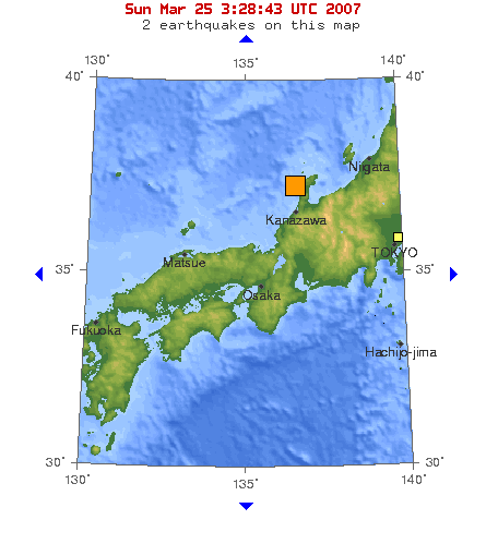
Map of Magnitude 6.7 earthquake in near the west coast of honshu(Noto Peninsula),Japan, 2007-03-25.
Source : [1]
This image is in the public domain in the United States because it only contains materials that originally came from the United States Geological Survey, an agency of the United States Department of the Interior. For more information, see the official USGS copyright policy.
|
บันทึกการอัพโหลด
| วันที่/เวลา | ขนาด | ผู้ใช้ | ความเห็น |
|---|---|---|---|
| 25 มีนาคม พ.ศ. 2550, 05:53:01 | 456 × 499 (33284 bytes) | Pekachu (คุย · ส่วนร่วม) | Map of Magnitude 6.7 earthquake in near the west coast of honshu([[w:Noto Peninsula|]]),Japan, 2007-03-25. Source : [https://earthquake.usgs.gov/eqcenter/recenteqsww/Maps/10/135_35.php] {{PD-USGov-USGS}} |
ประวัติไฟล์
คลิกวันที่/เวลาเพื่อดูไฟล์ที่ปรากฏในขณะนั้น
| วันที่/เวลา | รูปย่อ | ขนาด | ผู้ใช้ | ความเห็น | |
|---|---|---|---|---|---|
| ปัจจุบัน | 16:40, 21 กรกฎาคม 2557 | | 456 × 499 (29 กิโลไบต์) | GifTagger | Bot: Converting file to superior PNG file. (Source: 2007-03-25_Japan_Noto_earthquake.gif). This GIF was problematic due to non-greyscale color table. |
หน้าที่มีภาพนี้
หน้าต่อไปนี้ โยงมาที่ภาพนี้:
การใช้ไฟล์ข้ามโครงการ
วิกิอื่นต่อไปนี้ใช้ไฟล์นี้:
- การใช้บน ja.wikipedia.org
- การใช้บน ja.wikinews.org
- การใช้บน vi.wikipedia.org
- การใช้บน www.wikidata.org